Clayton Lake, Maine
| Clayton Lake, Maine | |
|---|---|
| Village | |
 Clayton Lake | |
| Coordinates: 46°36′39″N 69°31′20″W / 46.61083°N 69.52222°WCoordinates: 46°36′39″N 69°31′20″W / 46.61083°N 69.52222°W | |
| Country | United States |
| State | Maine |
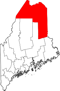
| County | Aroostook |
| Elevation | 1,056 ft (322 m) |
| Time zone | UTC-5 (Eastern (EST)) |
| • Summer (DST) | UTC-4 (EDT) |
| ZIP code | 04737[1] |
| Area code(s) | 207 |
| GNIS feature ID | 579199[2] |
Clayton Lake is an unincorporated village in Aroostook County, Maine, United States. The community is located within the Northwest Aroostook unorganized territory on the north shore of its eponymous lake within the North Maine Woods in southwestern Aroostook County.
References
- ↑ United States Postal Service. "USPS - Look Up a ZIP Code". Retrieved July 17, 2015.
- ↑ "Clayton Lake". Geographic Names Information System. United States Geological Survey.
This article is issued from
Wikipedia.
The text is licensed under Creative Commons - Attribution - Sharealike.
Additional terms may apply for the media files.