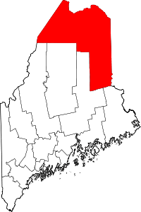
Cary Plantation, Maine
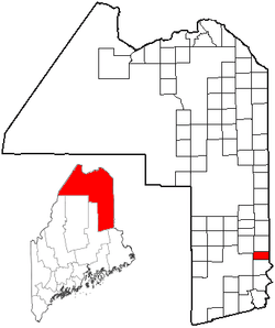
Cary Plantation is a plantation in Aroostook County, Maine. As of the 2010 census, it had a population of 218.[1] In July 2015, Cary Plantation residents began a plan to deorganize and become residents of the Maine Unorganized Territory.[2][3] However, in March 2016, the Maine Legislature rejected Cary Plantation's application, citing the financial burden deorganization would add to the remaining municipalities in Aroostook County.[4]
Geography
According to the United States Census Bureau, the plantation has a total area of 18.8 square miles (48.6 km2), all land.[1]
Demographics
| Historical population | |||
|---|---|---|---|
| Census | Pop. | %± | |
| 1890 | 390 | — | |
| 1900 | 400 | 2.6% | |
| 1910 | 340 | −15.0% | |
| 1920 | 327 | −3.8% | |
| 1930 | 241 | −26.3% | |
| 1940 | 287 | 19.1% | |
| 1950 | 278 | −3.1% | |
| 1960 | 208 | −25.2% | |
| 1970 | 184 | −11.5% | |
| 1980 | 229 | 24.5% | |
| 1990 | 235 | 2.6% | |
| 2000 | 217 | −7.7% | |
| 2010 | 218 | 0.5% | |
| Est. 2014 | 211 | [5] | −3.2% |
| U.S. Decennial Census[6] | |||
As of the census[7] of 2000, there were 217 people, 90 households, and 66 families residing in the plantation. The population density was 11.4 people per square mile (4.4/km²). There were 126 housing units at an average density of 6.6 per square mile (2.6/km²). The racial makeup of the plantation was 96.77% White, 0.46% African American, 1.84% Native American and 0.92% Asian. Hispanic or Latino of any race were 1.38% of the population.
There were 90 households out of which 25.6% had children under the age of 18 living with them, 66.7% were married couples living together, 3.3% had a female householder with no husband present, and 25.6% were non-families. 21.1% of all households were made up of individuals and 11.1% had someone living alone who was 65 years of age or older. The average household size was 2.41 and the average family size was 2.75.
In the plantation the population was spread out with 19.8% under the age of 18, 8.3% from 18 to 24, 26.7% from 25 to 44, 30.0% from 45 to 64, and 15.2% who were 65 years of age or older. The median age was 43 years. For every 100 females, there were 104.7 males. For every 100 females age 18 and over, there were 107.1 males.
The median income for a household in the plantation was $29,500, and the median income for a family was $40,000. Males had a median income of $26,563 versus $19,375 for females. The per capita income for the plantation was $15,172. About 9.1% of families and 14.1% of the population were below the poverty line, including 20.0% of those under the age of 18 and 17.5% of those 65 or over.
References
- 1 2 "Geographic Identifiers: 2010 Demographic Profile Data (G001): Cary plantation, Aroostook County, Maine". U.S. Census Bureau, American Factfinder. Retrieved May 21, 2013.
- ↑ Cyr, Joseph (July 31, 2015). "Cary Plantation moves forward with plan to dissolve town". Bangor Daily News. Retrieved 31 July 2015.
- ↑ Bidgood, Jess (January 16, 2016). "In Maine, Local Control Is a Luxury Fewer Towns Can Afford". The New York Times. Retrieved 18 January 2016.
- ↑ Higgins, AJ. "Officials Fear Domino Effect as Aroostook County Towns Try to Deorganize". Maine Public Broadcasting Network. Retrieved 13 March 2016.
- ↑ "Annual Estimates of the Resident Population for Incorporated Places: April 1, 2010 to July 1, 2014". Retrieved June 4, 2015.
- ↑ "Census of Population and Housing". Census.gov. Archived from the original on April 22, 2013. Retrieved June 4, 2015.
- ↑ "American FactFinder". United States Census Bureau. Archived from the original on 2013-09-11. Retrieved 2008-01-31.
Coordinates: 45°59′43″N 67°51′43″W / 45.99528°N 67.86194°W