Choluteca Department
| Choluteca Department Departamento de Choluteca | |
|---|---|
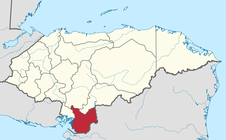 Location of Choluteca in Honduras | |
| Country | Honduras |
| Municipalities | 16 |
| Villages | 198 |
| Founded | June 28, 1825[lower-alpha 1] |
| Capital city | Choluteca |
| Government | |
| • Gobernador | Edgardo Tato Loucel (2018-2022) (PNH) |
| Area | |
| • Total | 4,397 km2 (1,698 sq mi) |
| Population (2015) | |
| • Total | 447,852 |
| • Density | 100/km2 (260/sq mi) |
| Time zone | UTC+6 (CDT) |
| Postal code | 51101, 51201 |
| ISO 3166 code | HN-CH |
| Statistics derived from Consult INE online database: Population and Housing Census 2013[1] | |
Choluteca is one of the 18 departments (departamentos) into which Honduras is divided. The departmental capital is city of Choluteca. The Choluteca river runs through the department.
History
In the mesoamerican classical period, the indigenous Cholultecas were engaged in trade in a vast territory encompassing the south of Mexico, Belize, Guatemala, parts of El Salvador and Nicaragua. In the exercise of this industry they reached the South Coast of Honduras, and founded the settlement of what is now the city of Choluteca hundreds of years before the Spanish conquest.
Choluteca was created as a division of colonial rule from Guatemala in March 1535. Upon independence from Spain, the department of Choluteca was created on June 28, 1825, as one of the seven original departments in which Honduras was divided after independence during the government of the first head of state of Honduras, Dionisio de Herrera. Its borders were changed twice after the original partition. In 1843 the district of Guascorán was added to its territory, until then part of Comayagua. In 1893 its westernmost part was split, with the creation of the Valle department.
Geography
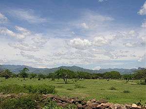
Choluteca is the southernmost department of Honduras with an area of 4360 km². In 2015 it had an estimated population of 447,852 inhabitants[1]. Chuleteca has many lands that are used for agriculture, fishing, sugar production, and shrimp farms. The head of the department is the city of Choluteca, which is located on the Choluteca river that crosses the department. One crosses the Choluteca Bridge to enter the city.
Choluteca is bordered to the north by the departments of Francisco Morazán and El Paraíso, to the west by the Golfo de Fonseca and the department of Valle, and to the east and south by Nicaragua.
Governance
Municipalities
Deputies
The Choluteca Department has a number of 9 deputies elected for the National Congress.
| Deputy | Departament | Party |
|---|---|---|
| Mauricio Oliva | Choluteca | PNH |
| Carlos Ledezma | Choluteca | PNH |
| Clara Laínez | Choluteca | PNH |
| Selvin Rueda | Choluteca | PNH |
| María Bardales | Choluteca | PNH |
| Yuri Sabas | Choluteca | PLH |
| Carlos Lara | Choluteca | PLH |
| Luis Martínez | Choluteca | Libre |
| David Reyes | Choluteca | PINU-SD |
Economy
The department is, historically, a prominent producer of gold, silver, and copper. The region also had a cattle industry.[2]
References
- 1 2 "Consulta Base de datos INE en línea: Censo de Población y Vivienda 2013" [Consult INE online database: Population and Housing Census 2013]. Instituto Nacional de Estadística (INE) (in Spanish). El Instituto Nacional de Estadística (INE). 1 August 2018. Retrieved 2018-09-13.
- ↑ Baily, John (1850). Central America; Describing Each of the States of Guatemala, Honduras, Salvador, Nicaragua, and Costa Rica. London: Trelawney Saunders. pp. 128–129.
Notes
- ↑ Choluteca was one of the first 7 departments in which the national territory was divided in the first political division of Honduras in 1825.
Coordinates: 13°19′N 87°13′W / 13.317°N 87.217°W