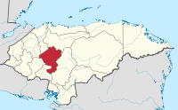
Comayagua Department
| Comayagua | |
|---|---|
| Department | |
 | |
| Coordinates: 14°27′N 87°38′W / 14.450°N 87.633°WCoordinates: 14°27′N 87°38′W / 14.450°N 87.633°W | |
| Country |
|
| Municipalities | 21 |
| Villages | 281 |
| Founded | 28 June 1825[lower-alpha 1] |
| Seat | Comayagua |
| Government | |
| • Type | Departmental |
| • Gobernador | Carlos Aguiluz Madrid (2018-2022, PNH) |
| Area | |
| • Total | 5,120 km2 (1,980 sq mi) |
| Population (2015)[1] | |
| • Total | 511,943 |
| • Density | 100/km2 (260/sq mi) |
| Time zone | UTC-6 (CDT) |
| Postal code | 12101 |
| ISO 3166 code | HN-CM |
| Statistics derived from Consult INE online database: Population and Housing Census 2013[2] | |
Comayagua (Spanish pronunciation: [komaˈʝaɣwa]) is one of the 18 departments (departamentos) into which Honduras is divided. The departmental capital is Comayagua.
Geography
The department covers a total surface area of 5,124 km² and, in 2015, had an estimated population of 511,943 people.
Economy
Historically, the department produced gold, copper, cinnabar, asbestos, and silver. Gems were also mined, including opal and emerald. The area was also known for "fine" cattle.[3]
Municipalities
Notes
- ↑ Comayagua was one of the first 7 departments in which the national territory was divided in the first political division of Honduras in 1825.
References
- ↑ "GeoHive - Honduras extended". Retrieved 2015. Check date values in:
|accessdate=(help) - ↑ "Consulta Base de datos INE en línea: Censo de Población y Vivienda 2013" [Consult INE online database: Population and Housing Census 2013]. Instituto Nacional de Estadística (INE) (in Spanish). El Instituto Nacional de Estadística (INE). 1 August 2018. Retrieved 2018-09-13.
- ↑ Baily, John (1850). Central America; Describing Each of the States of Guatemala, Honduras, Salvador, Nicaragua, and Costa Rica. London: Trelawney Saunders. pp. 128–129.
This article is issued from
Wikipedia.
The text is licensed under Creative Commons - Attribution - Sharealike.
Additional terms may apply for the media files.