Intibucá Department
| Intibucá Department Departamento de Intibucá | |
|---|---|
| Departmento | |
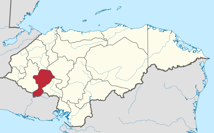 Location of Intibucá in Honduras | |
| Coordinates: 14°19′N 88°09′W / 14.317°N 88.150°WCoordinates: 14°19′N 88°09′W / 14.317°N 88.150°W | |
| Country |
|
| Municipalities | 17 |
| Villages | 126 |
| Founded | 16 Abril 1883 |
| Capital city | La Esperanza |
| Government | |
| • Type | Departmental |
| • Gobernador | Hodalma Lisseth Benítez Erazo (2018-2022) (PNH) |
| Area | |
| • Total | 3,126 km2 (1,207 sq mi) |
| Area rank | 14th |
| Population (2015) | |
| • Total | 241,568 |
| • Rank | 13th |
| • Density | 77/km2 (200/sq mi) |
| Time zone | UTC-6 (CDT) |
| Postal code | 14000, 14101, 14201 |
| ISO 3166 code | HN-IN |
| Statistics derived from Consult INE online database: Population and Housing Census 2013[1] | |
Intibucá (Spanish pronunciation: [ĩn̪.ti.ˈβu.ka]) is one of the 18 departments in the Republic of Honduras. Intibucá covers a total surface area of 1,186.1 square miles (3,072 km2). Its capital is the city of La Esperanza, in the municipality of La Esperanza.[2][3][4]
History
The department of Intibucá was created on April 16, 1883 upon recommendation of the Governor of the department of Gracias (now called Lempira), Jose Maria Cacho in 1869. He advised that the vast size of Gracias made it difficult to govern and that it would be desirable to divide it into more than one department.
On March 7, 1883 Decree No. 10 was issued, which called for the creation of a new department to be named Intibucá in April of that year. The town of La Esperanza was designated to be the capital of the new department. To create the new department, territory from both the departments of Gracias and La Paz were reassigned.
Geography
The department of Intibucá is situated between latitudes 13°51'E and 14°42'N and longitudes 87°46'W and 88°42'W. It is bounded on the north by the departments of Comayagua, Lempira, and Santa Bárbara, on the east by the departments of Comayagua and La Paz, on the west by the department of Lempira, and on the south by the Republic of El Salvador. Intibucá is the most mountainous district of Honduras. The capital of La Esperanza lies at an elevation of 4,950 feet (1,510 m) above sea level. The table-land and valleys are higher than in any other part of the country, and the ranges of the Cordilleras rise to an altitude approaching 10,000 feet (3,000 m) feet above sea level.[4]
The valley of Otoro is 30 km long by 8 km wide.
The Opalaca mountains have several ridges and crosses over into the department of La Paz. Sierra de Montecillos is a natural border with the departament of Comayagua, and contains the mountains Opatoro, Concepción, El Picacho, Goascotoro, El Granadino among others.
Rivers
Rivers of La Esperanza include the San Juan River and the Intibucá River, which passes through La Esperanza. Otoro River is a tributary of the Ulua River, and carries water to the Otoro valley. The Black River, known by the name of Guarajambala River, serves as a dividing line with the department of Lempira. Torola River and Gualcarque River flow into the Lempa river.
Population
According to the 1895 census, Intibucá had a population of 18,957 people at that time.[5] In 2015, it had grown to 241,568 people, divided among 17 municipalities and 126 villages (aldeas).[1]
Forest resources
The mountains and slopes are well supplied with pine and Oak forests, and the valleys thrive with fertile, well-watered soil, covered with vegetation characteristic of the temperate rather than tropical zone.[6][7]
Municipalities
Intibucá has the following municipalities of Honduras:
Notable residents
- General Vicente Tosta Carrasco, President of the country (1924-1925)
- Doctor Vicente Mejía Colindres, Constitutional presidente of the Republic (1929-1933)
- General Gregorio Ferrera, military officer, politician, and Honduran leader
- Rafael Manzanares Aguilar, Honduran folklorist, author and musical composer; founder and first director of the National Office of Folklore of Honduras (Oficina del Folklore Nacional de Honduras); founder and first director and choreographer of the Cuadro de Danzas Folklóricas de Honduras.
- Rafael Pineda Ponce, politician and educator, born in San Miguelito.
- Natanael del Cid Menedez, Politician, Rancher, Constitutionalist.
References
- 1 2 "Consulta Base de datos INE en línea: Censo de Población y Vivienda 2013" [Consult INE online database: Population and Housing Census 2013]. Instituto Nacional de Estadística (INE) (in Spanish). El Instituto Nacional de Estadística (INE). 1 August 2018. Retrieved 2018-09-13.
- ↑ Asociación de Municipios de Honduras. "Alcaldes y Alcaldesas". Retrieved 2013-10-14.
- ↑ BVS Nacionales. "Alcades de Honduras" (PDF). Retrieved 2013-10-14.
- 1 2 Alfred Keane Moe; John Hampden Porter (1904). Honduras: Geographical sketch, natural resources, laws, economic conditions, actual development, prospects of future growth. Internal Bureau of the American Republics, US Government Printing Office, Washington, D.C. pp. 44–46.
- ↑ Breve noticia del empadronamiento general de casas y habitantes de la República de Honduras practicado el 18 de diciembre de 1910 [Brief news of the general enumeration of houses and inhabitants of the Republic of Honduras practiced on December 18, 1910.] (in Spanish). Tegucigalpa, Honduras: Tipografía Nactional. 2011. pp. 6–7.
Pages 6-7 summarize the development of the population of Honduras from 1791 through 1910 according to the registrations, estimates, censuses and counts between the two years. Numbers of inhabitants are given for 1791, 1801, 1826, 1850, 1881, 1887, 1895, 1901, 1905, and 1910.
- ↑ Harcourt, C.; J. Sayer (1996). The Conservation Atlas of Tropical Forests: The Americas. Simon & Schuster, New York. ISBN 978-0133408867.
- ↑ George Powell, Sue Palminteri, Claudia Locklin, and Jan Schipper (WWF). "Tropical and Subtropical Coniferous Forests. Central America: Southern Mexico, Southern Guatemala, into Honduras, El Salvador, and Nicaragua". Retrieved 2013-10-15.
External links
- "La Esperanza Intibuca". Retrieved 2014-02-02.
- "Ballet Folklórico Oro Lenca". Retrieved 2016-05-05.
- "Geo Postal Codes database (Intibucá)". Mapanet. Madrid, España: Divex Turismo, S.L. Retrieved 11 January 2018.
- "Cuadro de Códigos de Departamentos y Municipios de Honduras" [Table of Honduran Department and Municipality Codes] (PDF). Registro Nacional de las Personas Honduras (RPN) (in Spanish). Tegucigalpa, Honduras. Retrieved 11 January 2018.