Chapadinha
| Chapadinha | ||
|---|---|---|
| Municipality | ||
| ||
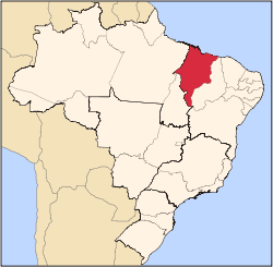
 Location in Maranhão state | ||
 Chapadinha Location in Brazil | ||
| Coordinates: 03°44′31″S 43°21′36″W / 3.74194°S 43.36000°WCoordinates: 03°44′31″S 43°21′36″W / 3.74194°S 43.36000°W | ||
| Country |
| |
| Region | Northeast Region | |
| State | Maranhão | |
| Area | ||
| • Total | 3,247 km2 (1,254 sq mi) | |
| Population (2015) | ||
| • Total | 77,684 | |
| • Density | 24/km2 (62/sq mi) | |
| Time zone | BRT (UTC-3) | |

Chapadinha is a Brazilian municipality in the state of Maranhão. It is located 235 km south-east of the state capital São Luís. The population is 77,684 (2015) and the total area is 3,247 km2.[1]
The municipality lies in the Munim River basin.[2] The municipality contains the 11,971 hectares (29,580 acres) Chapada Limpa Extractive Reserve, created in 2007.[3]
References
- ↑ "IBGE | Cidades | Maranhão | Chapadinha". cidades.ibge.gov.br. Retrieved 2016-05-19.
- ↑ Comitê de Bacia Hidrográfica do Rio Munim convoca primeira assembleia (in Portuguese), Governo do Maranhão, 14 September 2015, retrieved 2017-02-09
- ↑ RESEX Chapada Limpa (in Portuguese), ISA: Instituto Socioambiental, retrieved 2016-08-31
This article is issued from
Wikipedia.
The text is licensed under Creative Commons - Attribution - Sharealike.
Additional terms may apply for the media files.