Chandler's Ford
| Chandler's Ford | |
|---|---|
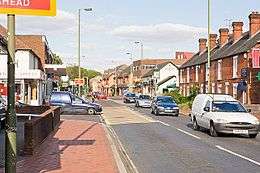 Junction of Winchester Road and Brownhill Road, Chandler's Ford | |
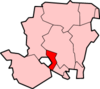
 Chandler's Ford Chandler's Ford shown within Hampshire | |
| Population | 21,436 [1] |
| OS grid reference | SU435212 |
| Civil parish |
|
| District | |
| Shire county | |
| Region | |
| Country | England |
| Sovereign state | United Kingdom |
| Post town | EASTLEIGH |
| Postcode district | SO53 |
| Dialling code | 023 |
| Police | Hampshire |
| Fire | Hampshire |
| Ambulance | South Central |
| EU Parliament | South East England |
| UK Parliament | |
Chandler's Ford (originally The Ford[2] and historically Chandlersford and known during the Second World War as Das Ford ) is a largely residential area and civil parish in the Borough of Eastleigh in Hampshire, England, with a population of 21,436 in the 2011 UK Census.[1]
Chandler's Ford lies on the old Winchester to Southampton road and the 'Ford' is thought to refer either to the ford of Monks Brook[3] on the Hursley Road (shown on the Hursley map of 1588 as "Charnells foord")[3] or on the Winchester-Southampton road.[2] The "Chandler's" prefix was added in the late 16th century,[2] and is derived from the surname, Chaundler, of a family in the area from the 14th Century.[4]
The head offices of Draper Tools,[5] B&Q,[6] Selwood and Ahmad Tea[7] are located in Chandler's Ford. Draper Tools has recently announced that they plan to move to Test Valley where they are currently building a new complex. In 2018, an Aldi supermarket opened in replacement of the old Homebase DIY store in the retail park on Chestnut Avenue - introducing new jobs and competition with ASDA (located opposite on the main roundabout).
History
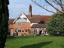
Hiltonbury Farm (now a public house) appeared on a map of 1588 and may originally have been owned by the Hursley Park Estate in nearby Hursley. It was later sold to Cranbury Park Estate and stopped being a working farm in the late 1970s, when the surrounding area was developed. Other communities revolved around other farms in the area but Chandler's Ford was very sparsely populated until the 19th century.
In 1889, an iron church and some schools were constructed.[8] The civil parish of Chandlersford was created in 1897, from portions of North Stoneham, North Baddesley, and Ampfield, although the railway station remained in the North Baddesley parish.[8]
Chandler's Ford used to be a town with mainly housing estates, however there are now various developments of shops and schools that have been built in the area. In the 1920s, building took place in the King's Court, Merdon and Hiltingbury areas. Later, development in the Hursley Road area happened, followed by housing across the Hiltingbury, Scantabout, Peverells Road, Spring Hill and Oakmount areas. More recently, developments in North Millers Dale, South Millers Dale and the 'new town' of Valley Park to the West of Chandler's Ford have completed the mix of housing. Chandler's Ford is considered to be the development to the West of the M3 motorway and now forms the majority of the Eastleigh urban area.
Due to the development of the town, there is little identifiable 'town centre'. The main commercial centre is in Fryern, the area of the Halfway Inn (near the old tollhouse for Winchester-Southampton), but other smaller shopping areas include the Central Precinct and the area around St Boniface Church (built 1904). An Anglican church was added in Hiltingbury in the 1960s, with the Roman Catholic Church of St. Edward the Confessor and Methodist churches existing on the main Winchester-Southampton route.
Although a mainly residential area, Chandler's Ford has a significant industrial estate located mainly off School Lane and in between the B3043 – Bournemouth Road. The companies on the industrial estate now cover a wide variety of industries from light engineering and manufacturing, distribution, retail and outsourcing. A number of employers on the estate are of particular local interest. Peter Green Furnishers were once regarded as the biggest furniture and carpeting store in the whole of Hampshire.[9] Selwoods is also another company of interest having been in the area since 1946[10] and with its head office on the corner of School Lane.
Chandler's Ford is represented by Compton and Chandler's Ford Cricket Club which formed in 1995 when Chandler's Ford Cricket Club (CC) merged with Compton and Shawford CC.
Chandler's Ford railway station was re-opened in May 2003, having been closed since 1969. It now has an hourly service run by South Western Railway, from Romsey to Salisbury via Chandler's Ford, Eastleigh and Southampton stopping at all stations in between.
An allegedly 'haunted' phone box once stood opposite the Hendy Ford car showroom. This was featured in the DVD "Haunted Hampshire", with noted historian Richard Felix. The phone box has since been removed following a number of reported cases of the phone constantly ringing and those responding to the calls finding themselves hearing silence on the other end.
Governance
Three members of parliament serve Chandler's Ford. The majority of Chandler's Ford was moved into Winchester constituency for the 2010 General Election, when Steve Brine of the Conservative Party was elected. Valley Park forms part of the Romsey and Southampton North constituency, won in 2010 by the Conservative Caroline Nokes. Part of the Eastleigh South ward lies west of the M3, and so is normally considered part of Chandler's Ford; it is in the Eastleigh constituency, represented by Conservative Mims Davies.
The Chandler's Ford seat on the Hampshire County Council is held by Judith Grajewski, representing the Conservative Party.[11] Parts of Chandler's Ford are also located in the Eastleigh South division, held by Wayne Irish of the Liberal Democrats[12] and the Baddesley division, represented by Alan Dowden of the Liberal Democrats.[13]
On Eastleigh Borough Council, Haulwen Broadhurst and Pamela Holden-Brown represent the Chandler's Ford East ward, while Alan Broadhurst and David Pragnell represent Chandler's Ford West, and Paul Bicknell, Darshan Mann and Steve Sollitt represent Eastleigh South; all seven are Liberal Democrats.[14] Hiltingbury West is represented by Judith Grajewski and Michael Hughes, and Hiltingbury East by Margaret Atkinson and Godfrey Olson; all four are Conservatives.[14] Valley Park lies in the Test Valley Borough and is represented by Liberal Democrats Andrew Beesley, Alan Dowden and Katherine Tilling.[15]
Chandler's Ford also has its own Parish Council, covering all of the area lying within Eastleigh Borough.[16]
Demography
As of April 2011, the Chandler's Ford and Hiltingbury council wards (which form a continuous built-up area, and make up the main part of what is referred to as "Chandler's Ford") had a population of 21,436, across 8,896 households.[1] The ethnicity of the population was mainly white, with 310 mixed race people, 937 Asian or Asian British people, 100 Black or Black British people and 224 in other ethnic groups.[1] In 2001, 13,531 of the population were Christians, 5,528 professed no religion, and 1,477 did not state their religious beliefs. There were 59 Buddhists, 205 Hindus, 29 Jews, 263 Muslims, 289 Sikhs and 55 people of other religions living in the ward.[1]
Healthcare
Nuffield Health Wessex Hospital provides private and NHS services.[17]
Transport
Rail
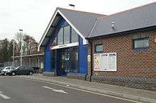
Chandler's Ford is served by Chandler's Ford railway station. The station was reopened for passenger traffic on 18 May 2003. There are links between Romsey and Salisbury via Southampton.
Bus
Bluestar's route 1 connects Chandlers Ford with Southampton and Winchester.
Road
The M3 runs past the eastern border of Chandler's Ford with access from junction 12 from the north and junction 13 from the south.
Crime
| Wikinews has related news: Two shot and killed in UK bank robbery |
Chandler's Ford made national headlines in September 2007 when an armed bank robbery was foiled: On 13 September 2007, the Metropolitan Police's Flying Squad, in conjunction with the Hampshire Constabulary, foiled the robbery outside the HSBC bank in the central precinct on Winchester Road in Chandler's Ford.[18] The police had been tipped off and hid behind the nearby toilet cubicles, before shooting dead two of the robbers. A third fled the scene by car and was later arrested.
There was another theft from the same bank on 24 January 2011, when a cash box was stolen from a security guard.[19]
Education
There are various schools and day nurseries in Chandler's Ford. The secondary schools in Chandler's Ford include Thornden School and Toynbee School. Chandler's Ford is served by colleges nearby, including Barton Peveril College.[20][21]
Day nurseries
Infant and primary schools
- Hiltingbury Infant School[24] (Hiltingbury Road, SO53 5NP)[25]
- Chandler's Ford Infant School[26] (Kings Road, SO53 2EY)[25]
- Fryern Infant School[27] (Oakmount Road, SO53 2LN)[25]
- Knightwood Primary School[28] (Bell Flower Way, SO53 4HW)[25]
- Scantabout Primary School[29] (Ionic Close, SO53 2NR)[25]
- Sherborne House School[30] (39 Lakewood Road, SO53 1EU)[25]
- St Francis Church of England Primary School[31] (Pilgims Close, Valley Park, SO53 4ST)[25]
- St. Swithun Wells R.C. Primary School[32] (Hillcrest Avenue, SO53 2JP)[25]
Junior schools
Secondary schools
- Thornden Secondary School[37] (Winchester Road, SO53 2DW)[38]
- Toynbee Secondary School[39] (Bodycoats Road, SO53 2PL)[38]
- Lakeside School (special school) (Winchester Road, SO53 2DW)[38]
Independent schools
- Sherborne House School[30] (39 Lakewood Road, SO53 1EU)[40]
- Education: Independent Schools [41]
Community
- Valley Park Community Association
- Chandler's Ford Community Association Community Centre, Hursley Rd, Chandler's Ford.
- Hiltingbury Recreation Ground Hiltingbury Road, Chandler's Ford.
References
- 1 2 3 4 5 "Neighbourhood Statistics: 2011: Key Statistics – Area: Chandler's Ford East (Ward)". 2011 UK Census. Office for National Statistics. Retrieved 15 October 2013. "Neighbourhood Statistics: 2011: Key Statistics – Area: Chandler's Ford West (Ward)". 2011 UK Census. Office for National Statistics. Retrieved 15 October 2013. "Neighbourhood Statistics: 2011: Key Statistics – Area: Hiltingbury East (Ward)". 2011 UK Census. Office for National Statistics. Retrieved 15 October 2013. "Neighbourhood Statistics: 2011: Key Statistics – Area: Hiltingbury West (Ward)". 2011 UK Census. Office for National Statistics. Retrieved 15 October 2013.
- 1 2 3 Cox, Gordon Daubney (2005). Around Eastleigh, including Chandler's Ford, Bishopstoke and Botley. Salisbury: Francis Frith Collection. p. 72. ISBN 1-84589-029-9.
- 1 2 Currie, Christopher (Spring 2005). "Chandler's Ford, Hiltingbury Lake and the Hursley map of 1588". Hampshire Field Club & Archaeological Society Newsletter (43).
- ↑ Mills, A. D. (1998). Dictionary of English Place Names. Oxford: Oxford University Press. p. 76. ISBN 0-19-280074-4.
- ↑ "Draper Tools – Welcome". Archived from the original on 24 January 2010.
- ↑ "About B&Q".
- ↑ "Client Stories – Ahmad Tea". Barclays. September 2010. Archived from the original on 9 August 2011. Retrieved 15 February 2011.
- 1 2 Page, William (1908). A History of the County of Hampshire: Volume 3. pp. 478–481.
- ↑ Martin, Wendy. "Mrs". Chandlers Ford Today. Retrieved 3 November 2015.
- ↑ "Selwood Company History". Selwood. Archived from the original on 8 February 2016. Retrieved 28 January 2016.
- ↑ info@hants.gov.uk, Hampshire County Council. The Castle, Winchester, Hampshire SO23 8UJ; (5 September 2017). "About your Hampshire County Councillor". www3.hants.gov.uk. Archived from the original on 5 January 2016. Retrieved 9 May 2017.
- ↑ "Election results for Eastleigh South, 4 May 2017". 4 May 2017. Retrieved 9 May 2017.
- ↑ "Archived copy". Archived from the original on 24 December 2014. Retrieved 12 November 2014.
- 1 2 http://www.eastleigh.gov.uk/meetings/mgMemberIndex.aspx?FN=WARD&VW=LIST&PIC=0
- ↑ http://testvalley.cmis.uk.com/testvalleypublic/ElectedRepresentatives/tabid/63/ScreenMode/Ward/Default.aspx#MemberSectionValleyPark
- ↑ "Chandler's Ford Parish Council website".
- ↑ "Wessex Hospital, Private Hospital in Hampshire | Nuffield Health". www.nuffieldhealth.com.
- ↑ BBC.Two men killed during 'bank raid'. BBC News. Retrieved 18 November 2007.
- ↑ "Robbers snatch bank cash". Eastleigh News. 2011-11-24.
- ↑ Education Archived 5 February 2012 at the Wayback Machine.
- ↑ Chandler's Ford Online: Schools Archived 31 August 2013 at the Wayback Machine.
- ↑ "Busy Bees at Chandlers Ford, local nursery for childcare". Busy Bees at Chandlers Ford.
- ↑ Education: Day Nurseries
- ↑ Hiltingbury Infant School: Website
- 1 2 3 4 5 6 7 8 Education: Infant and Primary Schools Archived 17 August 2011 at the Wayback Machine.
- ↑ Chandler's Ford Infant School: Website
- ↑ Fryern Infant School: Website Archived 11 August 2011 at the Wayback Machine.
- ↑ Knightwood Primary School: Website Archived 29 September 2006 at the Wayback Machine.
- ↑ "Scantabout Primary School | Scantabout Primary School Website". www.scantabout-pri.hants.sch.uk.
- 1 2 Sherborne House School: Website
- ↑ St Francis Church of England Primary School: Website
- ↑ St. Swithun Wells R.C. Primary School: Website
- ↑ Hiltingbury Junior School: Website
- 1 2 3 Education: Junior Schools Archived 10 August 2011 at the Wayback Machine.
- ↑ Fryern Junior School: Website
- ↑ Merdon Junior School: Website Archived 10 August 2007 at the Wayback Machine.
- ↑ Thornden Secondary School: Website
- 1 2 3 Education: Secondary Schools Archived 17 August 2011 at the Wayback Machine.
- ↑ Toynbee Secondary School: Website
- ↑ Education: Independent Schools Archived 10 August 2011 at the Wayback Machine.
- ↑ "Archived copy". Archived from the original on 10 August 2011. Retrieved 23 April 2012.
External links
| Wikimedia Commons has media related to Chandler's Ford. |
- Chandler's Ford Today
- Chandler's Ford Chameleon Theatre Company
- Compton and Chandler's Ford CC Website
- The Eastleigh Photograph Archive
- John Keble 's Parishes John Keble's Parishes – A History of Hursley and Otterbourne. (1898) Edited by Charlotte M. Yonge
- Local Rail Information
- Chandler's Ford News (on Eastleigh News website)
- A guide to Chandlers Ford on Hampshire Travel Guide
Settlements in the Borough of Eastleigh | ||
|---|---|---|
 | ||