Horton Heath, Hampshire

Countryside near Horton Heath

A colourful sunset near Horton Heath
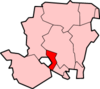
Horton Heath is a semi rural village and forms part of the civil parish of Fair Oak and Horton Heath in the borough of Eastleigh in Hampshire, England.[1][2][3] The village is about three miles south east of Eastleigh town centre. It adjoins Fair Oak.[1]
The village greatly expanded during the late 1980s and 1990s with developments such as The Drove and Meadowsweet way. A new Village hall was also built at this time.
It forms part of the Southampton Urban Area.
There are two public houses in Horton Heath, both on Botley Road. The Brigadier Gerard is situated at the southern end of Horton Heath and The Lapstone Inn is situated at the northern end.
References
- 1 2 Ordnance Survey: Landranger map sheet 185 Winchester & Basingstoke (Andover & Romsey) (Map). Ordnance Survey. 2013. ISBN 9780319228845.
- ↑ "Ordnance Survey Election Maps". www.ordnancesurvey.co.uk. Ordnance Survey. Retrieved 3 April 2016.
- ↑ "Fair Oak and Horton Heath Parish Council". www.fairoak-pc.gov.uk. Retrieved 3 April 2016.
External links
Settlements in the Borough of Eastleigh | ||
|---|---|---|
 | ||
Coordinates: 50°57′N 1°18′W / 50.950°N 1.300°W
This article is issued from
Wikipedia.
The text is licensed under Creative Commons - Attribution - Sharealike.
Additional terms may apply for the media files.