Cerro de las Ánimas
| Cerro de las Ánimas | |
|---|---|
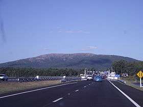 Cerro de las Ánimas viewed from a road (Ruta Interbalnearia) | |
| Highest point | |
| Elevation | 501 m (1,644 ft) |
| Coordinates | 34°45′07.38″S 55°19′10.54″W / 34.7520500°S 55.3195944°WCoordinates: 34°45′07.38″S 55°19′10.54″W / 34.7520500°S 55.3195944°W |
| Naming | |
| Translation | Hill of the Souls (Spanish) |
| Pronunciation | Spanish: [ˈsero ðelaˈsanimas] |
| Geography | |
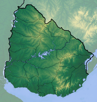 Cerro de las Ánimas Location in Uruguay | |
| Location |
Piriápolis, Maldonado Department, Uruguay |
| Parent range | Sierra de las Ánimas (part of Cuchilla Grande) |
| Geology | |
| Age of rock | Precambrian |
| Mountain type | Hill |
| Climbing | |
| Easiest route | Hike |
Cerro de las Ánimas ("Hill of the Souls", formerly known as Mirador Nacional) is a peak and the second highest point of Uruguay, with an altitude of 501 metres (1,643.7 ft).
Location and features
It is located to the southwest of the Maldonado Department, in the municipality of Piriápolis, in a similarly named range of hills which is named Sierra de las Ánimas.
Changing height calculations
Until 1973, this hill was considered the highest point of Uruguay.
However, in that year, a group of scientists of the Servicio Geográfico Militar (Military Geographic Service) changed the measure of the Cerro Catedral, currently considered the highest point of the country, with an altitude of 513.66 metres (1,685.24 feet).
See also
External links
- (in Spanish) Paseo Sierra de las Ánimas.
Capital: | ||
| Towns and villages | 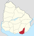 | |
| Sights | ||
This article is issued from
Wikipedia.
The text is licensed under Creative Commons - Attribution - Sharealike.
Additional terms may apply for the media files.