Cardurnock
| Cardurnock | |
|---|---|
 Cardurnock | |
 Cardurnock Cardurnock shown within Cumbria | |
| OS grid reference | NY1758 |
| Civil parish | |
| District | |
| Shire county | |
| Region | |
| Country | England |
| Sovereign state | United Kingdom |
| Post town | WIGTON |
| Postcode district | CA7 |
| Dialling code | 016973 |
| Police | Cumbria |
| Fire | Cumbria |
| Ambulance | North West |
| EU Parliament | North West England |
| UK Parliament | |
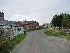
Cardurnock is a small settlement in Cumbria, England. It is by the coast, 20 kilometres (12 mi) west of Carlisle. The western extension of Hadrian's Wall once passed through the Cardurnock.[1] The sites of two small Roman fortlets, Milefortlet 4 and Milefortlet 5, have been located to the north and south of Cardurnock.[2][3]
References
- ↑ "The Western Extension of Hadrian's Wall: Bowness to Cardurnock": 236–243. JSTOR 525775.
- ↑ MILEFORTLET 4 Archived December 2, 2013, at the Wayback Machine., Pastscape, retrieved 26 November 2013
- ↑ MILEFORTLET 5 Archived December 3, 2013, at the Wayback Machine., Pastscape, retrieved 26 November 2013
External links
| Wikimedia Commons has media related to Cardurnock. |
This article is issued from
Wikipedia.
The text is licensed under Creative Commons - Attribution - Sharealike.
Additional terms may apply for the media files.