Milefortlet 4
| Milefortlet 4 | |
|---|---|
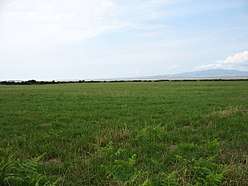 Fields by the Solway Firth, and the approximate site of Milefortlet 4 | |
 Location within Cumbria | |
| Type | Milecastle |
| Place in the Roman world | |
| Province | Britannia |
| Location | |
| Coordinates | 54°55′35″N 3°17′21″W / 54.926352°N 3.289258°WCoordinates: 54°55′35″N 3°17′21″W / 54.926352°N 3.289258°W |
| County | Cumbria |
| Country | England |
| Reference | |
| UK-OSNG reference | NY17475983 |
Milefortlet 4 (Herd Hill) was a Milefortlet of the Roman Cumbrian Coast defences. These milefortlets and intervening stone watchtowers extended from the western end of Hadrian's Wall, along the Cumbrian coast and were linked by a wooden palisade. They were contemporary with defensive structures on Hadrian's Wall. There is little to see on the ground but Milefortlet 4 has been located by archaeologists.
Description
Milefortlet 4 is situated at the seaward edge of a low ridge, just north of the hamlet of Cardurnock in the civil parish of Bowness. It was located in 1945 by the finding of turfwork on Herd Hill.[1] There is nothing to see from the ground but a geophysical survey of the site was undertaken in 1994 and the precise position of the milefortlet was located.[1]
Associated Towers
Each milefortlet had two associated towers, similar in construction to the turrets built along Hadrian's Wall. These towers were positioned approximately one-third and two-thirds of a Roman mile to the west of the Milefortlet, and would probably have been manned by part of the nearest Milefortlet's garrison. The towers associated with Milefortlet 4 are known as Tower 4A (grid reference NY172594) and Tower 4B (grid reference NY17115888).[2][3]
The position of Tower 4A is uncertain, although it thought to lie on the crest of a ridge with good views seaward.[2] Tower 4B is located in a field west of Cardurnock. It was excavated by in 1977, which located three sides of the tower surviving as robber trenches: the western side having been completely eroded.[3] The tower was interpreted as having had three phases: in the first two phases palisade structures were built, but in the third phase these were abandoned and a stone tower was built.[3]
References
- 1 2 Historic England, "Milefortlet 4 (9613)", PastScape, retrieved 26 November 2013
- 1 2 Historic England, "Tower 4A (9617)", PastScape, retrieved 26 November 2013
- 1 2 3 Historic England, "Cardurnock Tower 4B (9610)", PastScape, retrieved 26 November 2013
External links
- Historic England. "Herd Hill (milefortlet 4) (1014917)". National Heritage List for England.
- Historic England. "Cardurnock (tower 4b) (1016074)". National Heritage List for England.
Structures of Hadrian's Wall | ||
|---|---|---|
| Milecastles |  | |
| Milefortlets | ||
| Other structures on Hadrian's Wall | ||
| Regular and linear features | ||