Cannington Lake
| Cannington Lake | |
|---|---|
| Organized hamlet | |
| Organized Hamlet of Cannington Lake | |
 Cannington Lake | |
| Coordinates: 49°46′58″N 102°09′37″W / 49.78278°N 102.16028°W | |
| Country | Canada |
| Province | Saskatchewan |
| Region | South-eastern |
| Census division | 1 |
| Rural Municipality | Wawken |
| Government | |
| • Governing body | Rural Municipality of Wawken |
| • MP | Robert Kitchen |
| • MLA | Dan D'Autremont |
| Population (2016) | |
| • Total | 128 |
| • Density | 325.6/km2 (843/sq mi) |
| Time zone | CST |
| Area code(s) | 306 |
| Highways | Highway 16 |
| Railways | Canadian Pacific Railway |
| [1][2][3][4] | |
Cannington Lake is a hamlet within the Rural Municipality of Wawken No. 93, Saskatchewan, Canada. Listed as a designated place by Statistics Canada, the hamlet had a population of 0 in the Canada 2011 Census.[5]
Demographics
| Canada census – Cannington Lake community profile | |||
|---|---|---|---|
| 2011 | |||
| Population: | 0 (- 100.0% from 2006) | ||
| Land area: | 0.16 km2 (0.062 sq mi) | ||
| Population density: | |||
| Median age: | |||
| Total private dwellings: | |||
| Median household income: | $N/A | ||
| References: 2011[6] earlier[7] | |||
Cannington Resort
Cannington Resort currently has over 20 lots owned with 6 cabins currently occupied in the resort with residents.
Cannington Resort was once a popular resort, the population would grow in the summer months. It was home to several powered and unpowered campsites, several BBQ areas, 2 boat launches, a beach, several rent-able cabins, a miniature golf course and other services. Over the years the lake water levels declined severely so many of the residents had moved their cabins away. In recent years, lake levels have been on the rise which in turn may rejuvenate the area into a summer retreat once again.
Cannington Lake is an excellent location for anyone with a canoe or kayak as the lake is not too large and rarely has strong winds as it is in a bit of a valley. The resort also has a 6-7 km long nature path that is surrounded by no less than 5 ponds along the way and plenty of berry trees/bushes.
See also
References
- ↑ National Archives, Archivia Net, Post Offices and Postmasters
- ↑ Government of Saskatchewan, MRD Home, Municipal Directory System, archived from the original on November 21, 2008
- ↑ Canadian Textiles Institute. (2005), CTI Determine your provincial constituency
- ↑ Commissioner of Canada Elections, Chief Electoral Officer of Canada (2005), Elections Canada On-line
- ↑ Canada 2011 Census: Designated places in Saskatchewan
- ↑ "2011 Community Profiles". Canada 2011 Census. Statistics Canada. July 5, 2013.
- ↑ "2001 Community Profiles". Canada 2001 Census. Statistics Canada. February 17, 2012.
External links
| Subdivisions | |
|---|---|
| Communities | |
| Cities | |
| Topics |
|
| |
| Cities | 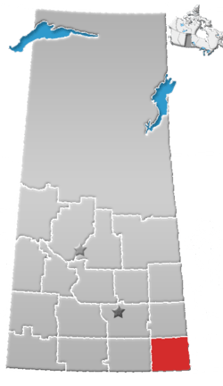 | ||||
|---|---|---|---|---|---|
| Towns | |||||
| Villages | |||||
| Rural municipalities | |||||
| First Nations | |||||
| Indian reserves | |||||
| Unincorporated communities |
| ||||
Coordinates: 49°46′58″N 102°09′37″W / 49.78278°N 102.16028°W