Candor, New York
| Candor | |
|---|---|
| Town | |
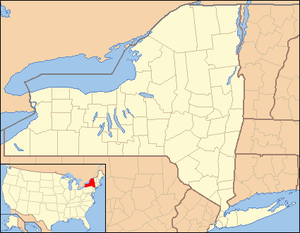 Candor Location of Candor in New York | |
| Coordinates: 42°13′42″N 76°20′12″W / 42.22833°N 76.33667°WCoordinates: 42°13′42″N 76°20′12″W / 42.22833°N 76.33667°W | |
| Country | United States |
| State | New York |
| County | Tioga |
| Area[1] | |
| • Total | 94.62 sq mi (245.06 km2) |
| • Land | 94.51 sq mi (244.78 km2) |
| • Water | 0.11 sq mi (0.28 km2) |
| Population (2010)[2] | |
| • Total | 5,305 |
| • Estimate (2016)[3] | 5,044 |
| • Density | 53.37/sq mi (20.61/km2) |
| Time zone | UTC-5 (Eastern (EST)) |
| • Summer (DST) | UTC-4 (EDT) |
| FIPS code | 36-107-12221 |
Candor is a town in Tioga County, New York, United States. The population was 5,305 at the 2010 census.
The Town of Candor has a village named Candor. The town is south of Ithaca, New York.
History
Settlement of the town began around 1794 on land purchased as part of the Watkins and Flint Patent of 1794.
The Town of Candor was formed from the Town of Spencer in 1811. Citizens wanted to name the town "Washington," but did not do so due to the existence of another town by that name in New York (Dutchess County). The source of the name "Candor" is unknown.
Candor was the community identified as "Springdale" in Vidich and Bensman's 1958 book, "Small Town in Mass Society."
Geography
According to the United States Census Bureau, the town has a total area of 94.6 square miles (245.0 km²), of which, 94.5 square miles (244.8 km²) of it is land and 0.1 square miles (0.2 km²) of it (0.06%) is water.
New York State Route 96 intersects New York State Route 96B in Candor village.
The West Branch of Owego Creek defines the east town line.
Demographics
| Historical population | |||
|---|---|---|---|
| Census | Pop. | %± | |
| 1820 | 1,655 | — | |
| 1830 | 2,653 | 60.3% | |
| 1840 | 3,370 | 27.0% | |
| 1850 | 3,433 | 1.9% | |
| 1860 | 3,840 | 11.9% | |
| 1870 | 4,250 | 10.7% | |
| 1880 | 4,323 | 1.7% | |
| 1890 | 3,674 | −15.0% | |
| 1900 | 3,330 | −9.4% | |
| 1910 | 2,911 | −12.6% | |
| 1920 | 2,639 | −9.3% | |
| 1930 | 2,564 | −2.8% | |
| 1940 | 2,601 | 1.4% | |
| 1950 | 2,879 | 10.7% | |
| 1960 | 3,488 | 21.2% | |
| 1970 | 4,190 | 20.1% | |
| 1980 | 4,919 | 17.4% | |
| 1990 | 5,310 | 7.9% | |
| 2000 | 5,314 | 0.1% | |
| 2010 | 5,305 | −0.2% | |
| Est. 2016 | 5,044 | [3] | −4.9% |
| U.S. Decennial Census[4] | |||
As of the census[5] of 2000, there were 5,317 people, 2,022 households, and 1,457 families residing in the town. The population density was 56.2 people per square mile (21.7/km²). There were 2,234 housing units at an average density of 23.6 per square mile (9.1/km²). The racial makeup of the town was 97.25% White, 0.85% Black or African American, 0.26% Native American, 0.19% Asian, 0.08% from other races, and 1.37% from two or more races. Hispanic or Latino of any race were 0.98% of the population.
There were 2,022 households out of which 36.0% had children under the age of 18 living with them, 56.6% were married couples living together, 10.2% had a female householder with no husband present, and 27.9% were non-families. 22.4% of all households were made up of individuals and 9.8% had someone living alone who was 65 years of age or older. The average household size was 2.63 and the average family size was 3.08.
In the town, the population was spread out with 28.1% under the age of 18, 7.2% from 18 to 24, 30.3% from 25 to 44, 22.5% from 45 to 64, and 11.9% who were 65 years of age or older. The median age was 36 years. For every 100 females, there were 96.3 males. For every 100 females age 18 and over, there were 94.1 males.
The median income for a household in the town was $37,633, and the median income for a family was $43,186. Males had a median income of $30,441 versus $22,324 for females. The per capita income for the town was $16,967. About 6.6% of families and 9.8% of the population were below the poverty line, including 12.3% of those under age 18 and 3.1% of those age 65 or over.
Education
Candor is served by the Candor Central School District.
Communities and locations in the Town of Candor
- Candor – The Village of Candor is in the center of the town.
- Catatonk – A hamlet near the south town line on NY-96.
- Catatonk Creek – A stream that flows southward through the town toward the Susquehanna River.
- Fairfield – A hamlet east of Candor village near the east town line.
- Gridleyville – A location northwest of Candor village on NY-96B.
- Hubbardtown – A location south of Candor village on NY-96.
- Perryville – A former location in the town, north of Candor village.
- Upper Fairfield – A hamlet north of Fairfield. It was also called "Blinn's Settlement," "Honey Pot," and "East Candor."
- Weltonville – A hamlet in the southeast corner of the town on County Road 33.
- West Candor – A location at the west town line on NY-96, partly in the Town of Spencer.
- Willseyville – A hamlet in the northeast part of the town on NY-96B. It was formerly called "Big Flatt."
In popular culture
- Harry Chapin's 1976 song, The Mayor of Candor Lied, references the town.
References
- ↑ "2016 U.S. Gazetteer Files". United States Census Bureau. Retrieved Jul 5, 2017.
- ↑ "American FactFinder". United States Census Bureau. Archived from the original on 2013-09-11. Retrieved 2011-05-14.
- 1 2 "Population and Housing Unit Estimates". Retrieved June 9, 2017.
- ↑ "Census of Population and Housing". Census.gov. Archived from the original on May 12, 2015. Retrieved June 4, 2015.
- ↑ "American FactFinder". United States Census Bureau. Archived from the original on 2013-09-11. Retrieved 2008-01-31.
External links
Municipalities and communities of Tioga County, New York, United States | ||
|---|---|---|
| Towns | 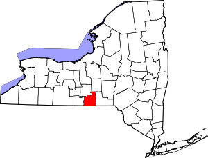 | |
| Villages | ||
| CDP | ||
| Other hamlets | ||