Can-avid, Eastern Samar
| Can-avid | |
|---|---|
| Municipality | |
| Municipality of Can-avid | |
| Motto(s): Upai Can-avid... Upayon Ta, Panlawas, Agrikultura ngan mga Industriya han Can-avid | |
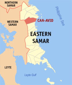 Map of Eastern Samar with Can-avid highlighted | |
.svg.png) Can-avid Location within the Philippines | |
| Coordinates: 12°00′N 125°27′E / 12°N 125.45°ECoordinates: 12°00′N 125°27′E / 12°N 125.45°E | |
| Country |
|
| Region | Eastern Visayas (Region VIII) |
| Province | Eastern Samar |
| District | Lone District |
| Founded | July 4, 1948 |
| Barangays | 28 (see Barangays) |
| Government [1] | |
| • Type | Sangguniang Bayan |
| • Mayor | Gil Norman P. Germino |
| • Electorate | 13,367 voters (2016) |
| Area [2] | |
| • Total | 288.7 km2 (111.5 sq mi) |
| Population (2015 census)[3] | |
| • Total | 21,015 |
| • Density | 73/km2 (190/sq mi) |
| Time zone | UTC+8 (PST) |
| ZIP code | 6806 |
| PSGC | 082605000 |
| IDD : area code | +63 (0)55 |
| Climate type | Tropical rainforest climate |
| Income class | 4th municipal income class |
| Revenue (₱) | 88,858,869.37 (2016) |
| Native languages |
Waray Tagalog |
| Website |
www |
Can-avid, (IPA: [ˌkɐnˈʔavɪd]), officially the Municipality of Can-avid, is a 4th class municipality in the province of Eastern Samar, Philippines. According to the 2015 census, it has a population of 21,015 people.[3]
Barangays
Can-avid is politically subdivided into 28 barangays. [2]
- Balagon
- Baruk
- Boco
- Caghalong
- Camantang
- Can-ilay
- Cansangaya
- Canteros
- Carolina
- Guibuangan
- Jepaco
- Mabuhay
- Malogo
- Obong
- Pandol
- Barangay 1 Poblacion
- Barangay 2 Poblacion
- Barangay 3 Poblacion
- Barangay 4 Poblacion
- Barangay 5 Poblacion
- Barangay 6 Poblacion
- Barangay 7 Poblacion
- Barangay 8 Poblacion
- Barangay 9 Poblacion
- Barangay 10 Poblacion
- Salvacion
- Solong
- Rawis
History
Can-avid was created in 1948 from the barrios of Can-avid, Carolina, Barok, Cansangaya, Mabuhay, Camantang, Canilay, Pandol and Balagon, formerly part of Dolores, Eastern Samar, by virtue of Republic Act No. 264.[4]
Demographics
| Population census of Can-avid | ||
|---|---|---|
| Year | Pop. | ±% p.a. |
| 1948 | 5,987 | — |
| 1960 | 8,409 | +2.87% |
| 1970 | 9,695 | +1.43% |
| 1975 | 11,135 | +2.82% |
| 1980 | 12,196 | +1.84% |
| 1990 | 13,254 | +0.84% |
| 1995 | 15,759 | +3.30% |
| 2000 | 17,228 | +1.93% |
| 2007 | 18,173 | +0.74% |
| 2010 | 19,785 | +3.14% |
| 2015 | 21,015 | +1.15% |
| Source: Philippine Statistics Authority[3] [5] [6] [7] | ||
In the 2015 census, the population of Can-avid, Eastern Samar, was 21,015 people,[3] with a density of 73 inhabitants per square kilometre or 190 inhabitants per square mile.
References
- ↑ "Municipality". Quezon City, Philippines: Department of the Interior and Local Government. Retrieved 31 May 2013.
- 1 2 "Province: Eastern Samar". PSGC Interactive. Quezon City, Philippines: Philippine Statistics Authority. Retrieved 12 November 2016.
- 1 2 3 4 Census of Population (2015). "Region VIII (Eastern Visayas)". Total Population by Province, City, Municipality and Barangay. PSA. Retrieved 20 June 2016.
- ↑ "An act to create the municipality of Can-avid in the province of Samar". LawPH.com. Retrieved 2011-04-08.
- ↑ Census of Population and Housing (2010). "Region VIII (Eastern Visayas)". Total Population by Province, City, Municipality and Barangay. NSO. Retrieved 29 June 2016.
- ↑ Censuses of Population (1903–2007). "Region VIII (Eastern Visayas)". Table 1. Population Enumerated in Various Censuses by Province/Highly Urbanized City: 1903 to 2007. NSO.
- ↑ "Province of Eastern Samar". Municipality Population Data. Local Water Utilities Administration Research Division. Retrieved 17 December 2016.
External links
- Philippine Standard Geographic Code
- Philippine Census Information
- Local Governance Performance Management System
Places adjacent to Can-avid, Eastern Samar | ||||||||||
|---|---|---|---|---|---|---|---|---|---|---|
| ||||||||||
Borongan (capital) | |
| Municipalities | |
| Component city | |
This article is issued from
Wikipedia.
The text is licensed under Creative Commons - Attribution - Sharealike.
Additional terms may apply for the media files.