Bukoto
| Bukoto | |
|---|---|
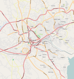 Bukoto Map of Kampala showing the location of Bukoto. | |
| Coordinates: 00°21′04″N 32°35′47″E / 0.35111°N 32.59639°ECoordinates: 00°21′04″N 32°35′47″E / 0.35111°N 32.59639°E | |
| Country |
|
| Region | Central Uganda |
| District | Kampala Capital City Authority |
| Division | Kampala Central Division |
| Arua | Arua |
| Elevation | 1,200 m (3,900 ft) |
| Time zone | UTC+3 (EAT) |
Bukoto is a township within the city of Kampala, Uganda's capital and largest metropolitan area.
Location
Bukoto is bordered by Kisaasi to the north, Kigoowa to the north-east, Ntinda to the east, Naguru to the south-east, Kololo to the south, Kamwookya to the west, and Kyebando to the north-west. This location is approximately 7 kilometres (4.3 mi), by road, north-east of Kampala's central business district.[1] The coordinates of Bukoto are 0°21'04.0"N, 32°35'47.0"E (Latitude:0.351111; Longitude:32.596400).[2]
Points of interest
The following points of interest lie inside or near Bukoto:
- The main branch of Pride Microfinance Limited, a Tier III Financial Institution, is located in Bukoto.
- Watoto Church - An orphnage and place of worship affiliated with the Pentecostal Church
- The Kampala Northern Bypass Highway - The highway passes through the northern reaches of Bukoto, in a west to east direction.
- Women's Hospital International and Fertility Centre - A private hospital specializing in the care of infertile couples.[3]
- Kadic Hospital, a 30-bed privately owned healthcare facility, a member of Kadic Health Services Limited.[4]
References
- ↑ "Map Showing Kampala and Bukoto With Distance Indicator". Globefeed.com. Retrieved 13 June 2014.
- ↑ Google. "Location of Bukoto At Google Maps". Google Maps. Retrieved 13 June 2014.
- ↑ WHI&FC (16 May 2016). "Women's Hospital International and Fertility Centre: Who We Are". Kampala: Women's Hospital International and Fertility Centre (WHI&FC). Retrieved 16 May 2016.
- ↑ Mwesigwa, Alon (12 August 2014). "Kasozi: How I Built A Shs5 Billion Hospital". The Observer (Uganda). Kampala. Archived from the original on 4 March 2016. Retrieved 16 May 2016.
External links

This article is issued from
Wikipedia.
The text is licensed under Creative Commons - Attribution - Sharealike.
Additional terms may apply for the media files.