Kololo
| Kololo | |
|---|---|
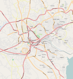 Kololo Map of Kampala showing the location of Kololo. | |
| Coordinates: 00°19′59″N 32°35′35″E / 0.33306°N 32.59306°E | |
| Country |
|
| Region | Central Uganda |
| District | Kampala |
| Division | Kampala Central Division |
| Elevation | 1,300 m (4,300 ft) |
| Time zone | UTC+3 (EAT) |
Kololo is a hill in Kampala, the largest city and capital of Uganda.
Location
Kololo is close to the centre of Kampala, bordered by Naguru to the east, Bukoto to the north, Mulago to the north-west, Makerere to the west, Nakasero to the south-west, and Kibuli to the south. Kololo is in the Kampala Central Division. The coordinates of Kololo are 0°19'46.0"N, 32°35'41.0"E (Latitude:0.329445; Longitude:32.594725).[1]
Overview
Kololo gets its name from the 19th century Acholi Chief Awich. From Northern Uganda, he, along with Kabalega of Bunyoro resisted British rule. He was arrested and brought to Kampala and incarcerated on top of Kololo Hill. Awich is alleged to have cried out in Luo, “An atye kany kololo”, which means “I am here alone.” Awich was lamenting over the fact that he had been left alone in the wilderness, miles away from home. His captors and the Baganda started calling the place the hill of Kololo, resulting in its name today.[2]
Since the 1950s, before Uganda's Independence, Kololo has been an upscale residential area because of its central location in the city and to the views from the hill. Kololo is a popular location for diplomatic missions to Uganda, housing more than a dozen embassies and ambassadors' residences.[3]
During the 2000s, hotels, banks, hospitals, and other corporate entities began to infiltrate the hill, mainly to serve those who reside there, away from the noise and traffic congestion in the central business district located on the neighbouring Nakasero hill. At the summit of the hill, there are radio, television and telecommunication masts.
Points of interest
The following points of interest are found on Kololo hill:
- acacia mall
- 7 hills international school
- Arya Sumaj School
- Casino Simba
- Centenary Park
- Dr. Stockley's Hospital
- East Kololo Primary School
- Embassy of Algeria
- Embassy of the People's Republic of China
- Embassy of the Democratic Republic of the Congo
- Embassy of Egypt
- Embassy of Germany
- Embassy of Sweden
- Embassy of Norway
- Embassy of Libya
- Embassy of North Korea
- Embassy of Russia
- Embassy of Rwanda
- Embassy of Saudi Arabia
- Embassy of South Africa
- High Commission of the Republic of Kenya
- Independence Park
- Jinja Road Police Station
- Kampala Christian Cemetery
- Kampala Golf Course
- Kampala Hospital
- Kololo Airstrip
- Kitante Hill Secondary School
- Kololo High School
- Kololo Senior Secondary School
- Kololo Hospital
- Lincoln International School
- Speke Apartments
- Uganda Management Institute
- Uganda National Museum
- Java House
- French School
- MTN Sports Arena Lugogo
- Torino Bar and Restaurant
Photos
See also
References
- ↑ Google. "Location of Kololo At Google Maps". Google Maps. Retrieved 17 June 2014.
- ↑ http://www.monitor.co.ug/artsculture/Reviews/Kololo-Hill-got-its-name-from-an-Acholi-chief/691232-1725100-67ie3m/index.html. Retrieved 17 October 2016. Missing or empty
|title=(help) - ↑ Mazinga, Mathias (2 December 2008). "Amazing Italian Jazz". New Vision. Archived from the original on 18 June 2014. Retrieved 17 June 2014.
