Dillon, Saskatchewan
| Dillon | |
|---|---|
 Dillon Location of Dillon in Saskatchewan | |
| Coordinates: 55°55′43″N 108°56′14″W / 55.92861°N 108.93722°W | |
| Country | Canada |
| Province | Saskatchewan |
| Government | |
| • Chief | Eillen Morrison |
| • MLA Athabasca | Buckley Belanger |
| • MP Desnethé—Missinippi—Churchill River | Georgina Jolibois |
| Area | |
| • Total | 86.32 km2 (33.33 sq mi) |
| Population (2011)[1] | |
| • Total | 764 |
| • Metro density | 8.9/km2 (23/sq mi) |
| Time zone | UTC−6 (Central Standard Time) |
| • Summer (DST) | UTC−5 |
| Postal code | S0M 0S0 |
| Highways | Hwy 925 |
| [2][3] | |
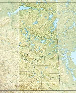
Dillon is an unincorporated community in the boreal forest of northern Saskatchewan, Canada. It is located on the western shore of Peter Pond Lake at the mouth of the Dillon River.[4] The community is the administrative headquarters of the Buffalo River Dene First Nations band government and is accessed by Highway 925 from Highway 155.
History
.jpg)
The North West Company had a post near Dillon in 1790. It was called Lac des Boeufs Post (Buffalo Lake Post).[5] The Hudson's Bay Company had a post nearby in 1791.
In 1819-1820 Sir John Franklin noted the position of the North West Company Post on Buffalo Lake (Peter Pond Lake) where Buffalo River (Dillon River) is located. (see map)
The first post office opened under the name of Buffalo River in 1926 and closed in 1929. In 1954 the post office was re-opened under the name of Dillon.[6]
Name changes
In 1932 the name of the community was officially changed from Buffalo River to Dillon, the name of the river was changed from Buffalo River to Dillon River and Buffalo Lake was renamed Peter Pond Lake.[7] A lake on the Dillon River just west of Vermette Lake also received its official name of Dillon Lake in 1932.[7]
The source of the Dillon River is in Alberta east of Lake Winefred near co-ordinates 55°30′00″N 110°15′32″W / 55.50°N 110.259°W.[7]
Buffalo River Dene Nation
Buffalo River Dene Nation has a total registered membership of 1,273 with 689 members residing on-reserve and 584 members residing at locations off-reserve as of May, 2012 [8] The total territory of the Buffalo River Dene Nation 193 is 8259.70 hectares.[9]
Demographics
| Canada census – Dillon, Saskatchewan community profile | |||
|---|---|---|---|
| 2011 | 2006 | ||
| Population: | 764 (+3.1% from 2006) | 741 (+22.1% from 2001) | |
| Land area: | 86.32 km2 (33.33 sq mi) | 86.32 km2 (33.33 sq mi) | |
| Population density: | 8.9/km2 (23/sq mi) | 8.6/km2 (22/sq mi) | |
| Median age: | 25.6 (M: 26.4, F: 25.0) | 22.8 (M: 23.0, F: 22.5) | |
| Total private dwellings: | 245 | 231 | |
| Median household income: | |||
| References: 2011[10] 2006[11] earlier[12] | |||
See also
References
- ↑ "2011 Community Profiles". Statistics Canada. Government of Canada. Retrieved 2012-03-06.
- ↑ Government of Saskatchewan, MRD Home. "Municipal Directory System". Archived from the original on 2016-01-15. Retrieved 2009-09-06.
- ↑ Commissioner of Canada Elections, Chief Electoral Officer of Canada (2005). "Elections Canada On-line". Archived from the original on 2007-04-21. Retrieved 2009-09-06.
- ↑ "Natural Resources Canada-Canadian Geographical Names (Dillon River)". Retrieved 2014-08-29.
- ↑ "ENCYCLOPEDIA OF SASKATCHEWAN (list of forts in Northern Saskatchewan)". Retrieved 2012-10-12.
- ↑ "Library and Archives Canada (Post Offices and Postmasters)". Archived from the original on 2012-11-03. Retrieved 2012-10-12.
- 1 2 3 "Geographical Names Query". Retrieved 2013-04-16.
- ↑ "AANDC (Registered Population)". Archived from the original on 2016-03-04. Retrieved 2012-10-12.
- ↑ "AANDC Reserves/Settlements/Villages". Archived from the original on 2016-03-04. Retrieved 2013-03-14.
- ↑ "2011 Community Profiles". Canada 2011 Census. Statistics Canada. July 5, 2013. Retrieved 2012-06-03.
- ↑ "2006 Community Profiles". Canada 2006 Census. Statistics Canada. March 30, 2011. Retrieved 2012-06-03.
- ↑ "2001 Community Profiles". Canada 2001 Census. Statistics Canada. February 17, 2012.
Places adjacent to Dillon, Saskatchewan | |
|---|---|
| Numbered Treaties | |
|---|---|
| Manitoba | |
| Saskatchewan | |