Peter Pond Lake
| Peter Pond Lake | |
|---|---|
 | |
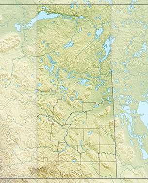
| Location | Saskatchewan |
| Coordinates | 55°55′00″N 108°44′03″W / 55.91667°N 108.73417°WCoordinates: 55°55′00″N 108°44′03″W / 55.91667°N 108.73417°W |
| Type | glacial lake |
| Primary inflows |
Dillon River La Loche River |
| Primary outflows | Churchill Lake |
| Catchment area | 9,713 km2 (3,750 sq mi) |
| Basin countries | Canada |
| Surface area | 552 km2 (213 sq mi) |
| Average depth | 13.7 m (45 ft) |
| Max. depth | 24 m (79 ft) |
| Water volume | 10.6 km3 (2.5 cu mi) |
| Residence time | 6.5 years |
| Shore length1 | 124 km (77 mi) |
| Surface elevation | 421 m (1,381 ft) |
| Settlements | Buffalo Narrows, Dillon, Michel Village |
| References | [2] |
| 1 Shore length is not a well-defined measure. | |
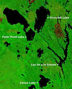
Peter Pond Lake is a glacial lake in Saskatchewan, Canada. It is located in northwestern Saskatchewan in the Boreal Forest and Canadian Shield within the Churchill River drainage basin. It was on the fur trade route to the Methye Portage which connected eastern Canada to the MacKenzie River area. The lake is a long oval tending to the northwest. A peninsula which almost reaches the west shore divides it into Big Peter Pond (the northern two thirds) and Little Peter Pond. On the west side of Little Peter Pond a narrow isthmus separates it from Churchill Lake, the two forming a broad "V". The La Loche River, which drains Lac La Loche comes in from the north while the Dillon River, with the village of Dillon at its mouth, comes in from the west. The lake drains into Churchill Lake through the Kisis Channel at Buffalo Narrows, Saskatchewan. Originally called Big and Little Buffalo Lakes, it was renamed after Peter Pond in 1931.[3] It is on Highway 155 which passes through Buffalo Narrows.
Gallery
.JPG) La Loche River as it flows south into Peter Pond Lake |
.jpg) John Franklin's Coppermine Expedition map of 1819–1822 shows the fur trade route from Île-à-la-Crosse to Methye Portage |
Fish Species
The lake's fish species include: walleye, sauger, yellow perch, northern pike, lake trout, lake whitefish, cisco, white sucker, longnose sucker and burbot. [4][5]
See also
References
- ↑ "NASA Visible Earth (BURN SCARS IN SASKATCHEWAN, CANADA) Note: Dark to light rust coloured areas are burn scars from forest fires". August 24, 2002. Retrieved 2014-09-14.
- ↑ "World Lake Database (Peter Pond Lake)". Archived from the original on 2012-03-18. Retrieved 2012-10-12.
- ↑ "Geographical Names Query". Retrieved 16 April 2013.
- ↑ "Fish Species of Saskatchewan" (PDF). Archived from the original (PDF) on 2011-07-19. Retrieved 2012-10-13.
- ↑ Anglersatlas.com