Brookwood, Surrey
| Brookwood | |
|---|---|
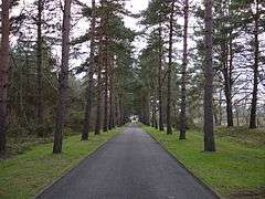 The Avenue leading from Brookwood Cemetery | |
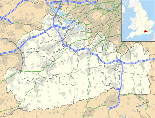 Brookwood Brookwood shown within Surrey | |
| Population | 2,565 (2011. Ward)[1] |
| OS grid reference | SU952570 |
| District | |
| Shire county | |
| Region | |
| Country | England |
| Sovereign state | United Kingdom |
| Post town | Woking |
| Postcode district | GU24 |
| Dialling code | 01483 |
| Police | Surrey |
| Fire | Surrey |
| Ambulance | South East Coast |
| EU Parliament | South East England |
| UK Parliament | |
Brookwood is a village in Surrey, England, located about 3 1⁄2 miles (5.6 km) west of Woking, in a semi-rural location. It lies on the western border of the Woking Borough, with a small part of the village in Guildford Borough.
The village is known for the vast 500-acre Brookwood Cemetery, also called the London Necropolis. The village also gave its name to the former Victorian Brookwood Hospital, once the leading mental institution in Surrey. Since its closure in 1994, it has been redeveloped as housing.
Geography
The village borders Knaphill, on the other side of the main A322 road, which is home to Brookwood Manor. The village also borders the Basingstoke Canal which has a flight of locks there. The Princess Royal Barracks, Deepcut is a short distance away to the west. The village is surrounded mainly by heathland such as Sheet's Heath, a Site of Special Scientific Interest, Smart's Heath and Brookwood Heath.
The main road is Connaught Road, a long road containing mixed Victorian terraces, a variety of semi-detached and larger detached houses. Branching off are smaller cul-de-sacs with more modern houses, some which back onto the canal itself. Along the road, there is a primary school which has been established for over a century.[2]
History
The village has grown over the 150 or so years since the vast cemetery and station first set roots in this area. Many of London's dead were buried in Brookwood Cemetery during the Victorian era due to the over-population of the city at that time. The logistics were accomplished using the London Necropolis Railway, consisting of funeral trains running from London Waterloo railway station to Brookwood and subsequently down a small branch line into the cemetery grounds. This branch-line is now disused. The main station and nearby public house are at least 100 years old.
It is possible that the village was founded in the Anglo-Saxon period, as the word Brook is derived from 'Brock'. 'Brock' being Old English for Badger, so in a literal sense the village of Brookwood translates to 'badger wood'. The badger can be seen on the village crest and on the school uniform.
Transport
The village has a train station on the South Western Main Line which has four trains an hour each way. The junction with the Alton Line is about 1 1⁄4 miles (2 km) further west. Across the railway, a mile to the south is the village of Pirbright. There is also a regular bus service to Guildford, Woking and Frimley. The village is on the approach pattern for Farnborough airport.
Local sports teams and organisations
Currently, Brookwood has one local football team playing within it. This is Brookwood and District Football Club. They were formed in 2007 and currently play in the Surrey and Hants Border League Division 3. Last season 2009/10 they were winners of the Prince Albert Cup, beating Abbey Rangers 5-4 in the match at Surrey Sports Park.
Youth organisations
Brookwood is home to quite a number of youth organisations and clubs. Most of these meet at either the Memorial Hall, St Saviours Church or are based in the school.
Brookwood Scout Group meets in the Memorial hall every week during term time and offers both boys and girls between the ages of six and fourteen with the opportunity to take part in a wide range of activities and adventure. The group is a member of the Scout Association and covers the youngest three age bands that the Association caters for (Beavers, Cubs and Scouts).
Angling at Brookwood Country Park
Goldsworth Park Angling Club, established 2015, manages angling at Goldsworth Park Lake and Brookwood Ponds, under license with Woking Borough Council.
See also
References
- ↑ "Woking Ward population 2011". Neighbourhood Statistics. Office for National Statistics. Retrieved 5 October 2016.
- ↑ Brookwood Primary School
External links
| Wikimedia Commons has media related to Brookwood, Surrey. |
| Towns, villages and hamlets |  | ||||
|---|---|---|---|---|---|
| Parks | |||||
| Places of worship | |||||
| Education | |||||
| Transport | |||||
| Buildings and structures | |||||
| Sport |
| ||||