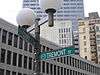
Brookline Avenue
Route map:
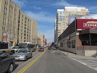
Brookline Avenue is a principal urban artery in the city of Boston, Massachusetts, terminating in the town of Brookline. The Landmark Center, Fenway Park, Emmanuel College, Longwood Medical and Academic Area and Kenmore Square are sites along its length.[1] It runs from Kenmore Square in the Fenway-Kenmore neighborhood, forming a 1.5-mile straight line to its other terminus at Washington Street in the Brookline Village neighborhood of Brookline, Massachusetts.[2]
Along its way, the street intersects (from east to west) Boylston Street, Park Drive, the Fenway, and the Riverway, crossing the Emerald Necklace twice; the street ends at Brookline Avenue's westernmost crossing of the Necklace.
The road was laid out between 1818 and 1821 during the construction of the Boston & Roxbury Mill Dam across Boston's Back Bay.[3] It led from the western end of the dam at Sewall's Point (now Kenmore Square) to the Punch Bowl Tavern on Washington Street in Brookline. The road was known by various names, including the Punch Bowl Road, the Mill Dam Road, and Western Avenue. (Mill Dam Road and Western Avenue were also used for the road that crossed the dam (now Beacon Street) and for its extension west to Brighton. "Brookline Branch" was sometimes used to distinguish this road from the others.[4]) The name Brookline Avenue was officially adopted in 1868.[5]
References
Notes
- ↑ Transportation Study Appendix
- ↑ Google Maps
- ↑ "The Western Avenue". Boston Daily Advertiser. 14 July 1821.
- ↑ A Record of the Streets, Alleys, Places, Etc. in the City of Boston. City of Boston Printing Department. 1910.
- ↑ "Town records of Brookline, Massachusetts". archive.org. Retrieved 2017-07-26.
External links