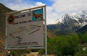
Broghil Valley National Park
| Broghil Valley | |
|---|---|
| بروغل | |
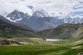 Broghil Valley NP conserves the valley’s dramatic landscapes | |
 Broghil Valley | |
| Area | 124,964 ha (308,790 acres) |
| Geography | |
| Coordinates | 36°10′N 73°23′E / 36.167°N 73.383°ECoordinates: 36°10′N 73°23′E / 36.167°N 73.383°E |
Broghil Valley (Urdu: بروغل) is a valley and national park located in the upper northern reaches Chitral District, of Pakhtunkhwa, Pakistan. It is located close to the Afghan-Pakistan border.
Location
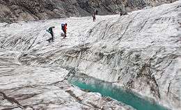
ChitiBoui Glacier Broghil valley
Broghil valley is located at a distance of 250 km from main Chitral town and is the northern most valley of Chitral district in Khyber Pakhtunkhwa.
Geography
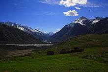
The area is mostly mountainous tracts. Elevations range from 3,280m at Kishmanjah village to 4,304m at Karamber Lake in northeast. The terrain is undulating, with steep mountains, wide stretch grassy plains and narrow valleys. The total area of peatlands and lakes is almost 3,400 ha.[1]
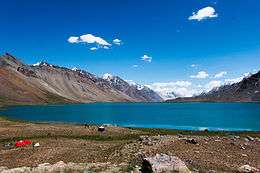
Karambar (Qurumber) Lake in Broghil Valley of Khyber Pakhtunkhwa province, Pakistan's 2nd highest lake which is famous for its pristine water.
Water clarity level is 13.75 (Secchi Disc Reading), which is highest value ever recorded in the literature of lakes in Pakistan.
The Chikaar region of the valley.
See also
References
- ↑ Hydrological assessment of significant lakes in Broghil and Qurumbar Valleys, Northern Alpine Wetlands Complex.
External links
This article is issued from
Wikipedia.
The text is licensed under Creative Commons - Attribution - Sharealike.
Additional terms may apply for the media files.