Brockport, New York
| Village of Brockport | |
|---|---|
| Village | |
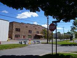 The old Brockport Cold Storage Co. Building on the corner of Oxford and Spring Streets. | |
 Location in Monroe County and the state of New York. | |
.svg.png) Location of New York in the United States | |
| Coordinates: 43°12′51″N 77°56′22″W / 43.21417°N 77.93944°WCoordinates: 43°12′51″N 77°56′22″W / 43.21417°N 77.93944°W | |
| Country | United States |
| State | New York |
| County | Monroe |
| Incorporated | 1829 |
| Government | |
| • Mayor | Margaret Blackman |
| Area | |
| • Total | 2.2 sq mi (6 km2) |
| • Land | 2.2 sq mi (6 km2) |
| • Water | 0.1 sq mi (0.3 km2) |
| Elevation | 518 ft (158 m) |
| Population (2010) | |
| • Total | 8,366 |
| • Estimate (2017)[1] | 8,299 |
| Time zone | UTC-5 (EST) |
| • Summer (DST) | UTC-4 (EDT) |
| ZIP code | 14420 |
| Area code(s) | 585 |
| FIPS code | 36-08466 |
| Website | www.brockportny.org |
Brockport is a village in the Town of Sweden, with two tiny portions in the Town of Clarkson, in Monroe County, New York, USA. The population was 8,336 at the 2010 census. The name is derived from Heil Brockway, an early settler.
The Village of Brockport is in Monroe County's western part, west of the City of Rochester. The village is north of the junction of New York State Route 19 (north-south) and New York State Route 31 (east-west) at the Sweden's northern town line.
Brockport calls itself "The Victorian Village on the Erie Canal." Brockport recently remodeled the village portion of the Erie canal, providing a bricked walkway, a brand new canal visitor's center, and several pieces of art.
History
The Village of Brockport was founded by Heil Brockway in 1823 and later incorporated in 1829. This village was founded around 1820 and grew to importance as a port on the Erie Canal, and the village was briefly the canal's terminus until the canal's western end was complete. Prior to becoming a village, the area that makes up modern Brockport was primarily occupied by the Muoio Indian tribe, a part of the Seneca (a member of the Iroquois Confederacy). The Muoio people were sustained in the region mostly by hunting indigenous wildlife such as deer and the occasional black bear. Shortly after white settlers arrived, most of the Muoio died of disease and the few survivors traveled to Canada.
During the American Civil War the men of Brockport, New York formed the majority of Company A (100 men) of the 140th New York Volunteer Infantry Regiment formed in Rochester, NY in September 1862, when the village's total population was little more than 2100 people. They also helped form Company H of the 140th New York Volunteer Infantry Regiment. The 140th New York regiment served in the XII Corps and V Corps of the Army of the Potomac and saw battle at the Battle of Gettysburg, The Battle of the Wilderness, The Battle of Spotsylvania Court House and the Appomatox Courthouse Campaign. The 140th New York Volunteer Infantry Regiment was mustered out on June 3, 1865 near Alexandria, VA.
The State University of New York at Brockport, officially called "College at Brockport, State University of New York", is located in Brockport, as well as the Brockport Central School District. It also boasts the Morgan Manning House, an old Victorian home on Main Street (NY 19).
There has long been a legend that due to a conflict between two of Brockport's founders, there are no intersections on Main St. that meet up squarely. This is not true, since State Street and Erie street line up because they used to be a trolley path that ran all the way to Rochester. Adams Street and Fair street meet up as well, and so do the streets of Brockway Place and South Avenue.
Due to financial difficulties the village was under threat of dissolution, and could have become a part of the town of Sweden pending a referendum by the village's residents, but the referendum failed on June 15, 2010.[2] However, there was another dissolution vote on May 24, 2016, that was also failed,[3] filed by resident Rhett King on January 25, 2016. Village clerk Leslie Ann Morelli certified the petition and found 339 signatures that are registered voters. There was to be a study, however, it was rejected.[4]
Sites of interest
The Erie Canal runs through the village of Brockport, as well as several other area villages and towns.
Main Street (Route 19) has many historical buildings, and is a tourist attraction. The Erie Canal Boardwalk that runs from Main Street along the canal is a common spot for locals to enjoy a stroll.
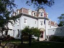
The Morgan-Manning House houses the Western Monroe Historical Society and was listed on the National Register of Historic Places in 1991. Brockport has the following places listed on the National Register of Historic Places: Brockport Central Rural High School (currently A.D. Oliver Middle School), First Baptist Church, First Presbyterian Church, Edward Harrison House, Lake View Cemetery, Main Street Historic District, Park Avenue and State Street Historic District, Soldiers' Memorial Tower, St. Luke's Episcopal Church, and Whiteside, Barnett and Co. Agricultural Works.[5][6][7][8][9]
Government
Geography
Brockport is located at 43°12′51″N 77°56′22″W / 43.21417°N 77.93944°W (43.214261, -77.939378).[10]
According to the United States Census Bureau, the village has a total area of 2.2 square miles (5.7 km2), of which, 2.2 square miles (5.7 km2) of it is land and 0.1 square miles (0.26 km2) of it (2.26%) is water.
Demographics
| Historical population | |||
|---|---|---|---|
| Census | Pop. | %± | |
| 1830 | 792 | — | |
| 1840 | 1,249 | 57.7% | |
| 1850 | 1,500 | 20.1% | |
| 1860 | 2,143 | 42.9% | |
| 1870 | 2,817 | 31.5% | |
| 1880 | 4,039 | 43.4% | |
| 1890 | 3,742 | −7.4% | |
| 1900 | 3,398 | −9.2% | |
| 1910 | 3,579 | 5.3% | |
| 1920 | 2,980 | −16.7% | |
| 1930 | 3,611 | 21.2% | |
| 1940 | 3,590 | −0.6% | |
| 1950 | 4,748 | 32.3% | |
| 1960 | 5,256 | 10.7% | |
| 1970 | 7,878 | 49.9% | |
| 1980 | 9,776 | 24.1% | |
| 1990 | 8,749 | −10.5% | |
| 2000 | 8,103 | −7.4% | |
| 2010 | 8,366 | 3.2% | |
| Est. 2017 | 8,299 | [1] | −0.8% |
| U.S. Decennial Census[11] | |||
As of the census[12] of 2010, there were 8,366 people, 2,528 households, and 1,094 families residing in the village.
The village's racial makeup was 91.7% White, 3.8% African American, 0.3% Native American, 1.3% Asian, 0.1% Pacific Islander, 0.9% from other races, and 1.9% from two or more races. Hispanic or Latino of any race were 3.8% of the population.
There were 2,528 households, out of which 17.9% had children under the age of 18 living with them, 10.1% had a female householder with no husband present, and 56.7% were non-families. 33.9% of all households were made up of individuals and 7.8% had someone living alone who was 65 years of age or older. The average household size was 2.25 and the average family size was 2.86.
In the village, the population was spread out with 13.7% under the age of 18, 43.8% from 18 to 24, 16.4% from 25 to 44, 17.8% from 45 to 64, and 8.1% who were 65 years of age or older. The median age was 22.3 years. For every 100 females, there were 84.0 males. For every 100 females age 18 and over, there were 83.2 males.
The village's median household income was $46,292, and the median family income was $68,397. Males had a median income of $52,639 versus $38,630 for females. The village's per capita income was $18,102. About 8.7% of families and 25.3% of the population were below the poverty line, including 12.4% of those under age 18 and 14.0% of those age 65 or over.
2009 homicides
In 2009, Brockport saw its first homicide in 26 years in a shooting spree that ended in Canandaigua.[13] On Saturday, February 14, 2009, shortly before 5 a.m., three people were shot, two fatally, by gunman Frank Garcia at Lakeside Memorial Hospital on West Ave. (NYS Route 19 Truck). Garcia later shot two other people dead. He was taken into custody the same day.[14]
Notable people
- Larry Carpenter, theater and television director
- Jerome Fuller, jurist
- Mary Jane Holmes (1825–1907), author of about forty novels [15]
- Fannie Barrier Williams, Black social reformer
- Andy Parrino, American professional baseball player
- Jeff Van Gundy, NBA coach and broadcaster
- Davis Carpenter, former US Congressman
- Carolyn Mackler, author
- Jim Cosman, major league baseball player.
- Jon Finkel, professional Magic: The Gathering player.
- Elias B. Holmes, former US Congressman
- Sumner Howard, jurist and politician
- Martin Ferrero, actor
- Christopher John Farley, writer
- Ella D. Barrier
References
- 1 2 "Population and Housing Unit Estimates". Retrieved June 9, 2017.
- ↑ "TWC News - Rochester - Finger Lakes, Batavia". Retrieved 21 April 2016.
- ↑ http://www.brockportny.org/news/news-announcements/210-village-dissolution-defeated
- ↑ Amanda Allen. "Dissolution Information". Archived from the original on 23 March 2016. Retrieved 21 April 2016.
- ↑ National Park Service (2010-07-09). "National Register Information System". National Register of Historic Places. National Park Service.
- ↑ "National Register of Historic Places Listings". Weekly List of Actions Taken on Properties: 3/28/11 through 4/01/11. National Park Service. 2011-04-08.
- ↑ "National Register of Historic Places". WEEKLY LIST OF ACTIONS TAKEN ON PROPERTIES: 10/17/11 THROUGH 10/21/11. National Park Service. 2011-10-29.
- ↑ "National Register of Historic Places Listings". Weekly List of Actions Taken on Properties: 11/07/11 through 11/10/11. National Park Service. 2011-11-18.
- ↑ "National Register of Historic Places Listings". Weekly List of Actions Taken on Properties: 8/24/15 through 8/28/15. National Park Service. 2015-09-04.
- ↑ "US Gazetteer files: 2010, 2000, and 1990". United States Census Bureau. 2011-02-12. Retrieved 2011-04-23.
- ↑ "Census of Population and Housing". Census.gov. Archived from the original on May 12, 2015. Retrieved June 4, 2015.
- ↑ "American FactFinder". United States Census Bureau. Archived from the original on 2013-09-11. Retrieved 2014-11-28.
- ↑ "Man Held in Four Killings Near Rochester"
- ↑ "Four dead in shooting spree in upstate New York counties". CNN.com. February 15, 2009. Retrieved March 6, 2009.
- ↑ Urness, Carol L. (c. 1971). "Holmes, Mary Jane Hawes". In James, Edward T. Notable American Women 1607–1950: A Biographical Dictionary. II: G-O. James, Janet Wilson; Boyer, Paul S. Cambridge, MA: The Belknap Press of Harvard University Press. pp. 208–209. ISBN 0-674-62734-2. Retrieved June 18, 2010.
External links
- Village of Brockport webpage.
- SUNY Brockport webpage.
- Brockport Central Schools webpage.
- Seymour Library - A public library serving Brockport, Clarkson, & Sweden NY
- Images from in & around Brockport
- Brockport Real Estate Listings
- Brockport Symphony Orchestra
Municipalities and communities of Monroe County, New York, United States | ||
|---|---|---|
| City | 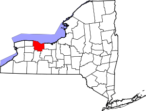 | |
| Towns | ||
| Villages | ||
| CDPs | ||
| Other hamlets | ||
| Footnotes | ‡This populated place also has portions in an adjacent county or counties | |