Botsford Parish, New Brunswick
| Botsford | |
|---|---|
| Parish | |
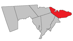 Location within Westmorland County, New Brunswick. | |
| Coordinates: 46°11′N 64°36′W / 46.19°N 64.60°W | |
| Country |
|
| Province |
|
| County | Westmorland County |
| Established | 1805 |
| Area[1] | |
| • Land | 304.00 km2 (117.38 sq mi) |
| Population (2011)[1] | |
| • Total | 1,074 |
| • Density | 3.5/km2 (9/sq mi) |
| • Pop 2006-2011 |
|
| • Dwellings | 1,160 |
| Time zone | UTC-4 (AST) |
| • Summer (DST) | UTC-3 (ADT) |
Botsford is a parish in Westmorland County, New Brunswick, Canada.[2]
History
Botsford Parish erected from Sackville Parish in 1805: named for Amos Botsford (1742-1812), a Loyalist from Connecticut, who settled in Sackville.
Delineation
Botsford Parish is defined in the Territorial Division Act[3] as being bounded:
- Northeast by Northumberland Strait, south by Baie Verte; west by Westmorland County[lower-alpha 1] and a line running magnetic south by the year eighteen hundred and twenty-four to Cumberland grant line, or its northerly prolongation from the northeast angle of a tract of fourteen hundred acres, granted to Thomas Doiron and others, at the mouth of Tedish River.
Communities
Parish population total does not include incorporated municipalities (in bold).
|
|
|
Demographics
| Historical population | ||
|---|---|---|
| Year | Pop. | ±% |
| 1991 | 1,328 | — |
| 1996 | 1,297 | −2.3% |
| 2001 | 1,216 | −6.2% |
| 2006 | 1,203 | −1.1% |
| 2011 | 1,074 | −10.7% |
| [4] | ||
Access routes
Highways and numbered routes that run through the parish, including external routes that start or finish at the parish limits:[5]
|
|
|
|
See also
Footnotes
- ↑ The word County did not occur in the previous Revised Statutes of New Brunswick. What's meant here is Westmorland Parish; the error occurred when the Revised Statutes of New Brunswick were updated in 1973. The boundary actually runs along a prolongation of the Westmorland Parish line until it strikes the boundary between Shediac Parish and Sackville Parish.
References
- 1 2 2011 Statistics Canada Census Profile: Botsford Parish, New Brunswick
- ↑ New Brunswick Provincial Archives - Botsford Parish
- ↑ "Territorial Division Act (R.S.N.B. 1973, c. T-3)". Government of New Brunswick website. Retrieved 17 August 2016.
- ↑ Statistics Canada: 2001, 2006 census
- ↑ Atlantic Canada Back Road Atlas ISBN 978-1-55368-618-7
External links
Places adjacent to Botsford Parish, New Brunswick | |
|---|---|
| Subdivisions | |
|---|---|
| Cities | |
| Counties | |
| |
Coordinates: 46°06′41″N 63°58′32″W / 46.111326°N 63.975449°W
This article is issued from
Wikipedia.
The text is licensed under Creative Commons - Attribution - Sharealike.
Additional terms may apply for the media files.