Bombo, Uganda
| Bombo | |
|---|---|
 Bombo Location in Uganda | |
| Coordinates: 00°34′40″N 32°32′42″E / 0.57778°N 32.54500°E | |
| Country |
|
| Region | Central Region |
| District | Luweero District |
| Population (2014 Census) | |
| • Total | 26,370[1] |
Bombo is a town in Luweero District in the Central Region of Uganda.
Location
Bombo is approximately 32 kilometres (20 mi), by road, north of Uganda's capital, Kampala.[2] The coordinates of Bombo are 0°34'36.0"N, 32°32'42.0"E (Latitude:0.576667; Longitude:32.545000).[3]
Overview
Bombo is one of three town councils in Luweero District, the other two being Luweero and Wobulenzi. All three municipalities are located on the Kampala - Masindi highway, that continues to Gulu and Arua in the Northern Region.
The town has a large Nubian minority, the Nubians having settled there when they came from Sudan to serve in the British Colonial army.
Bombo has an army barracks and was the headquarters of the Ugandan Ministry of Defense until December 2007, when they moved to Mbuya in Nakawa Division in south-eastern Kampala. Bombo, however, remains the headquarters of the Uganda Land Forces.[4]
Former Bombo District
The area in which Bombo town is a main township became Bombo District, one of the first regions that initially received district status when Uganda became independent in October 1962. In 1967, the district was renamed East Mengo. In 1974, Uganda reorganized from districts into provinces, and East Mengo became the Province of Bombo. Provinces were reorganized into districts in 1980, and the district of Luwero was created, with Bombo town as one of the main town councils.[5]
Population
In 2002, the national census estimated the population the town to be 16,699. In 2010, the Uganda Bureau of Statistics (UBOS), estimated the population at 20,500. In 2011, UBOS estimated the mid-year population ar 21,000.[6] In August 2014, the national population census put the population at 26,370.[1]
See also
References
- 1 2 UBOS (27 August 2014). "The Population of The Regions of the Republic of Uganda And All Cities And Towns of More Than 15,000 Inhabitants". Uganda Bureau of Statistics (UBOS). Retrieved 22 February 2015 – via Citypopulation.de.
- ↑ "Road Distance Between Kampala And Bombo With Interactive Map". Globefeed.com. Retrieved 22 February 2015.
- ↑ Google (3 July 2015). "Location of Bombo At Google Maps" (Map). Google Maps. Google. Retrieved 3 July 2015.
- ↑ Defense Headquarters moved from Bombo to Mbuya Archived 26 December 2007 at the Wayback Machine., The Monitor, 25 December 2007
- ↑ Ocwich, Denis (7 August 2005). "Can Uganda's Economy Support More Districts?". New Vision (Kampala). Archived from the original on 29 May 2015. Retrieved 22 February 2015.
- ↑ UBOS (2012). "Estimated Population of Bombo In 2002, 2010 & 2011" (PDF). Uganda Bureau of Statistics (UBOS). Archived from the original (PDF) on 7 July 2014. Retrieved 22 February 2015.
External links
Capital: Luweero | ||
| Towns and villages | 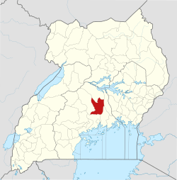 | |
| Economy | ||
| Education |
| |
| Notable landmarks | ||
| Health | ||
| Transport |
| |
| Notable people | ||