Luweero
| Luweero, Uganda Luweero Municipality | |
|---|---|
 Luweero, Uganda Location in Uganda | |
| Coordinates: 00°49′59″N 32°29′58″E / 0.83306°N 32.49944°E | |
| Country |
|
| Region | Central Region of Uganda |
| District | Luweero District |
| Elevation | 3,600 ft (1,100 m) |
| Population (2014 Census) | |
| • Total | 42,734[1] |
Luweero is a town in the Central Region of Uganda. It is the main municipal, administrative, and commercial center of Luweero District.
Location
Luweero is approximately 75 kilometres (47 mi), by road, north of Kampala, Uganda's capital and largest city, on the highway to Masindi. The road is a busy, all-weather tarmac highway.[2] The coordinates of the town are 0°49'59.0"N, 32°29'58.0"E (Latitude:0.833056; Longitude:32.499444).[3]
Overview
Luweero is one of several municipalities in Luweero District.
Population
The population of the town of Luweero was estimated at 23,500 during the 2002 national census. In 2010, the Uganda Bureau of Statistics (UBOS) estimated the population at approximately 28,800. In 2011, UBOS estimated the mid-year population at 29,500.[4] During the national population census of 2014, the population was enumerated at 42,734.[1]
Points of interest
In Luweero or near the town, there are several points of interest, including the following:
- Headquarters of Luweero District Administration
- Offices of Luweero Town Council
- Headquarters of the Roman Catholic Diocese of Kasana–Luweero
- Headquarters of the SeventhDay Adventist North Buganda station.(SeventhDay Adventist Church)
- Headquarters of the Anglican Luweero Diocese (Church of Uganda)
- Luweero Central Market
- Headquarters of Wekembe SACCO (microfinance institution)
- Kampala-Masindi highway, passing through the center of town in a north/south alignment.
See also
References
- 1 2 UBOS (27 August 2014). "The Population of The Regions of the Republic of Uganda And All Cities And Towns of More Than 15,000 Inhabitants". Citypopulation.de Quoting Uganda Bureau of Statistics (UBOS). Retrieved 23 February 2015.
- ↑ "Distance Between Kampala And Luweero With Map". Globefeed.com. Retrieved 1 May 2014.
- ↑ Google (14 July 2015). "Location of Luweero At Google Maps" (Map). Google Maps. Google. Retrieved 14 July 2015.
- ↑ "Estimated Population of Luweero In 2002, 2010 & 2011" (PDF). Uganda Bureau of Statistics. Archived from the original (PDF) on 7 July 2014. Retrieved 1 May 2014.
External links
- Profile of Luweero District
- Luweero Diocese (Church of Uganda)
Capital: Luweero | ||
| Towns and villages | 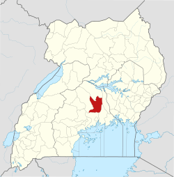 | |
| Economy | ||
| Education |
| |
| Notable landmarks | ||
| Health | ||
| Transport |
| |
| Notable people | ||