Bollendorf
| Bollendorf | ||
|---|---|---|
 | ||
| ||
 Bollendorf Location of Bollendorf within Eifelkreis Bitburg-Prüm district 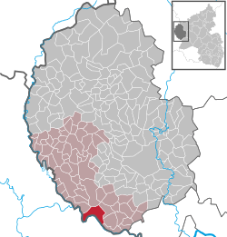 | ||
| Coordinates: 49°51′11″N 06°21′42″E / 49.85306°N 6.36167°ECoordinates: 49°51′11″N 06°21′42″E / 49.85306°N 6.36167°E | ||
| Country | Germany | |
| State | Rhineland-Palatinate | |
| District | Eifelkreis Bitburg-Prüm | |
| Municipal assoc. | Südeifel | |
| Government | ||
| • Mayor | Rolf Stump | |
| Area | ||
| • Total | 13.15 km2 (5.08 sq mi) | |
| Elevation | 200 m (700 ft) | |
| Population (2017-12-31)[1] | ||
| • Total | 1,691 | |
| • Density | 130/km2 (330/sq mi) | |
| Time zone | CET/CEST (UTC+1/+2) | |
| Postal codes | 54669 | |
| Dialling codes | 06526 | |
| Vehicle registration | BIT | |
| Website | www.bollendorf.de | |


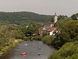
Catholic parish church Sankt Michael
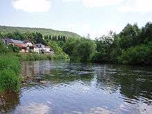
The Sauer in Bollendorf
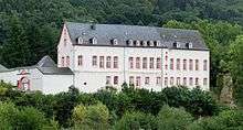
Bollendorf castle
Bollendorf is a German municipality in the state of Rhineland-Palatinate, located on the left bank of the Sauer river, opposite the Luxembourgish town of Bollendorf-Pont.
| Wikimedia Commons has media related to Bollendorf. |
References
- ↑ Statistisches Landesamt Rheinland-Pfalz "Bevölkerungsstand 2017 - Gemeindeebene" Check
|url=value (help). Statistisches Landesamt Rheinland-Pfalz (in German). 2018.
| Authority control |
|---|
This article is issued from
Wikipedia.
The text is licensed under Creative Commons - Attribution - Sharealike.
Additional terms may apply for the media files.