Daleiden
| Daleiden | ||
|---|---|---|
| ||
 Daleiden Location of Daleiden within Eifelkreis Bitburg-Prüm district 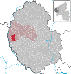 | ||
| Coordinates: 50°4′11″N 6°10′56″E / 50.06972°N 6.18222°ECoordinates: 50°4′11″N 6°10′56″E / 50.06972°N 6.18222°E | ||
| Country | Germany | |
| State | Rhineland-Palatinate | |
| District | Eifelkreis Bitburg-Prüm | |
| Municipal assoc. | Arzfeld | |
| Government | ||
| • Mayor | Walter Reichert (CDU) | |
| Area | ||
| • Total | 15.59 km2 (6.02 sq mi) | |
| Elevation | 452 m (1,483 ft) | |
| Population (2017-12-31)[1] | ||
| • Total | 850 | |
| • Density | 55/km2 (140/sq mi) | |
| Time zone | CET/CEST (UTC+1/+2) | |
| Postal codes | 54689 | |
| Dialling codes | 06550 | |
| Vehicle registration | BIT | |
| Website | www.daleiden.de | |

Daleiden is a municipality in the district of Bitburg-Prüm, in Rhineland-Palatinate, western Germany.
Geography
Daleiden is located six kilometers away from the border to Luxembourg. The highest point of the village is called "Hohe Haardt" which is 505 metres high. Further parts of the municipality of Daleiden are Bermichthof, Bommert, Burtdell, Falkenauel, Feder, Kalenbornerhof, Laarberg, Neuhof, Schwabert, Vor der Höh, Zingent and Zinglersseif.[2]
References
- ↑ Statistisches Landesamt Rheinland-Pfalz "Bevölkerungsstand 2017 - Gemeindeebene" Check
|url=value (help). Statistisches Landesamt Rheinland-Pfalz (in German). 2018. - ↑ "Statistisches Landesamt, Verzeichnisse und Adressarien" (PDF). Archived from the original (PDF) on 25 November 2015. Retrieved 6 January 2016.
| Authority control |
|---|
This article is issued from
Wikipedia.
The text is licensed under Creative Commons - Attribution - Sharealike.
Additional terms may apply for the media files.