Bolívar, Uruguay
| Bolívar | |
|---|---|
| Village | |
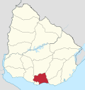
 Bolívar Location in Uruguay | |
| Coordinates: 34°13′59″S 55°43′59″W / 34.23306°S 55.73306°WCoordinates: 34°13′59″S 55°43′59″W / 34.23306°S 55.73306°W | |
| Country |
|
| Department | Canelones Department |
| Population (2011) | |
| • Total | 139 |
| Time zone | UTC -3 |
| Postal code | 91401 |
| Dial plan | +598 4311 (+4 digits) |
Bolívar is a village in Canelones Department, Uruguay.
Location
The village is located on the banks of Santa Lucía River, along Route 7 and about 75 kilometres (47 mi) northeast of Montevideo.
History
On 4 February 1886, it was declared a "Pueblo" (village) by Decree.[1]
Population
In 2011 Bolívar had a population of 139.[2]
| Year | Population |
|---|---|
| 1963 | 110 |
| 1975 | 107 |
| 1985 | 100 |
| 1996 | 152 |
| 2004 | 94 |
| 2011 | 139 |
Source: Instituto Nacional de Estadística de Uruguay[1]
References
- 1 2 "Statistics of urban localities (1963–2004)" (PDF). INE. 2012. Retrieved 6 September 2012.
- ↑ "Censo 2011 - Canelones (needs flash plugin)". INE. 2012. Archived from the original on 7 September 2012. Retrieved 29 August 2012.
External links
Capital: Canelones | ||
| Towns and villages |
|  |
| Resorts of the Ciudad de la Costa | ||
| Sights |
| |
This article is issued from
Wikipedia.
The text is licensed under Creative Commons - Attribution - Sharealike.
Additional terms may apply for the media files.