Boambee, New South Wales
| Boambee Coffs Harbour, New South Wales | |||||||||||||||
|---|---|---|---|---|---|---|---|---|---|---|---|---|---|---|---|
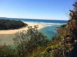 Boambee Bay | |||||||||||||||
| Population | 1,668 (2016 census)[1] | ||||||||||||||
| LGA(s) | City of Coffs Harbour | ||||||||||||||
| State electorate(s) | Electoral district of Coffs Harbour | ||||||||||||||
| Federal Division(s) | Division of Cowper | ||||||||||||||
| |||||||||||||||
Boambee is a suburb in the city of Coffs Harbour on the Mid North Coast of New South Wales, Australia. Boambee is west of Sawtell on the Pacific Highway. It is divided into two sections: semi-rural Boambee (2450) and the more suburban Boambee East (2452). These suburbs are divided by the Pacific Highway. In 2011, Boambee had a population of 1,545 people,[2] while Boambee East had a population of 5,446 people.[3]
The Boambee State Forest is located to the north-west of Boambee's residential areas.[4]
History
Industry
1882 saw the establishment of the first sugar mill in Boambee by James Newport, who was the first to grow sugar cane in the region. August Schneider opened another mill in 1883.[5]
Railway
Boambee railway station was opened in August 1917, closing in 1946. In the years prior to 1917 the area had been served by a sliding.[6]
| Preceding station | NSW Main lines | Following station | ||
|---|---|---|---|---|
towards Border Loop | North Coast Line | towards Maitland |
Schools
Boambee Half-Time School opened in February 1902 and continued as such until closing in April 1906. The closure was short-lived,being re-opened as Boambee Provisional School in May 1906. This was converted to a Public School in July 1907 suggesting that the school population had increased to the twenty required then for the creation of a public school.[7]
Population
In the 2016 Census, there were 1,668 people in Boambee. 81.7% of people were born in Australia and 88.5% of people spoke only English at home. The most common responses for religion were No Religion 26.3%, Catholic 21.9% and Anglican 20.8%.[1]
References
- 1 2 Australian Bureau of Statistics (27 June 2017). "Boambee (State Suburb)". 2016 Census QuickStats. Retrieved 18 March 2018.

- ↑ Australian Bureau of Statistics (31 October 2012). "Boambee (State Suburb)". 2011 Census QuickStats. Retrieved 24 October 2012.
- ↑ Australian Bureau of Statistics (31 October 2012). "Boambee East (State Suburb)". 2011 Census QuickStats. Retrieved 24 October 2012.
- ↑ Forests NSW
- ↑ PIONEERS OF COFFS HARBOUR & DISTRICT, Believed to be compiled By G.E. England, undated Archived 24 July 2008 at the Wayback Machine.
- ↑ Page 1 SAWTELL RESERVE PLAN OF MANAGEMENT,PUBLIC EXHIBITION DRAFT, JULY 2008
- ↑ State Records Authority of NSW
Coordinates: 30°20′S 153°05′E / 30.333°S 153.083°E