Blowhard, Victoria
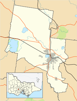
Blowhard, is a rural locality 17.7 km (10.99827 statute miles) from Ballarat, in South Western Victoria, Australia. It is located between Creswick and Learmonth. Blowhard was once a prominent mining area.[2]
The name blowhard is a term commonly used to describe a pompous person.
Mt Blowhard Primary School was erected by the Education Department in 1878 and is still operating as a primary school. [3]
At the 2016 census, Blowhard had a population of 84.[1]
References
- 1 2 "Blowhard". Australian Bureau of Statistics. Australian Bureau of Statistics. Retrieved 2 September 2018.
- ↑ "MINING REVIVAL AT BALD HILLS". The Ballarat Star. XXV, (104). Victoria, Australia. 1 May 1880. p. 3. Retrieved 13 November 2016 – via National Library of Australia.
- ↑ Hopkins, Ben`. "Mt Blowhard Primary School celebrates its 140th birthday". The Courier. The Courier. Retrieved 2 September 2018.
|
This article is issued from
Wikipedia.
The text is licensed under Creative Commons - Attribution - Sharealike.
Additional terms may apply for the media files.