Black Lake (Gull River)
| Black Lake | |
|---|---|
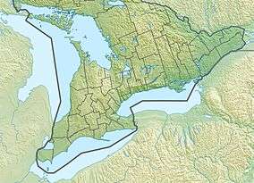 Black Lake Location in Southern Ontario | |
| Location | Haliburton County, Ontario |
| Coordinates | 44°49′07″N 78°49′29″W / 44.81861°N 78.82472°WCoordinates: 44°49′07″N 78°49′29″W / 44.81861°N 78.82472°W[1] |
| Primary inflows | South Portage Creek |
| Primary outflows | South Portage Creek |
| Basin countries | Canada |
| Max. length | 2.2 metres (7 ft 3 in) |
| Max. width | 0.9 metres (2 ft 11 in) |
| Surface elevation | 270 metres (890 ft)[2] |
Black Lake is a lake in the municipality of Minden Hills, Haliburton County in Central Ontario, Canada.[1] It is part of the Great Lakes Basin and lies within geographic Lutterworth Township.[3]
The lake is approximately 2 kilometres long and 1 kilometre at its widest point, and the primary inflow, at the north, and outflow, at the south, is Black Creek. Black Creek flows to the Gull River, which in turn flows via the Kawartha Lakes, the Otonabee River and the Trent River to Lake Ontario. There is one named and privately owned island, Casimir Island.
Access to the lake is via two privately maintained roads leading east off of Ontario Highway 35, between the communities of Norland and Minden. There is a shared dock and approximately 100 cottages on the lake.
At the southern outflow, Black Creek offers marshy habitat to wildlife, such as loons, deer, beavers, and herons, as well as boating access to Moore Lake on the eastern side of Highway 35. At the south-eastern end, there are several cliffs.
See also
References
- 1 2 "Black Lake". Geographical Names Data Base. Natural Resources Canada. Retrieved 2014-06-20.
- ↑ Taken from Google Earth at geographic coordinates, accessed 2014-06-20.
- ↑ "Lutterworth" (PDF). Geology Ontario - Historic Claim Maps. Ontario Ministry of Northern Development, Mines and Forestry. Archived from the original (PDF) on 2016-03-04. Retrieved 2014-06-20.
Other map sources:
- Map 5 (PDF) (Map). 1 : 700,000. Official road map of Ontario. Ministry of Transportation of Ontario. 2014. Retrieved 2014-06-20.
- Restructured municipalities - Ontario map #5 (Map). Restructuring Maps of Ontario. Ontario Ministry of Municipal Affairs and Housing. 2006. Retrieved 2014-06-20.