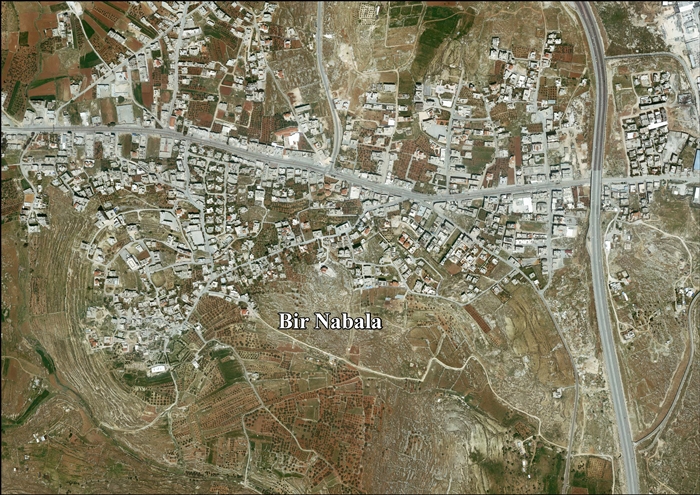
Bir Nabala
| Bir Nabala | |
|---|---|
| Other transcription(s) | |
| • Arabic | بير نبالا |
| • Also spelled | Beer Nabala (official) |
 Bir Nabala | |
 Bir Nabala Location of Bir Nabala within Palestine | |
| Coordinates: 31°51′06″N 35°12′03″E / 31.85167°N 35.20083°ECoordinates: 31°51′06″N 35°12′03″E / 31.85167°N 35.20083°E | |
| Palestine grid | 168/139 |
| Governorate | Jerusalem |
| Government | |
| • Type | Village council |
| Area | |
| • Jurisdiction | 1,904 dunams (1.9 km2 or 0.7 sq mi) |
| Population (2006) | |
| • Jurisdiction | 6,100 |
| Name meaning | The well of apparatus[1] |

Bir Nabala (Arabic: بير نبالا; Hebrew: ביר נבאלא) is a Palestinian town in the West Bank located eight kilometers northeast of Jerusalem. In mid-year 2006, it had an estimated population of 6,100 residents.[2] Three Bedouin tribes — Abu Dhak, Tel al ‘Adassa[3] and Jahalin — live in Bir Nabala. Bir Nabala has a built-up area of 1,904 dunams, which combined with nearby al-Jib, Beit Hanina al Balad and al-Judeira form an enclave in the Seam Zone, walled in by the Israeli West Bank barrier.[4] The enclave is home to approximately 15,000 Palestinians.[5] It is linked to Ramallah by underpasses and a road that is fenced on both sides. From the Biddu enclave, residents travel along a fenced road that passes under a bypass road to Bir Nabala enclave, then on a second underpass under Bypass Road 443 to Ramallah.[6]
Prior to the construction of the barrier, Bir Nabala was a commercial center linking Jenin and Tulkarm with the Jerusalem area and the town contained about 600 shops and six tyre factories. In 2007, there were 180 shops and two tyre factories.[7]
History
The remains of a vault, dating to the Crusader era have been found here.[8]
Ottoman era
In 1517, the village was included in the Ottoman empire with the rest of Palestine and in the 1596 tax-records it appeared as Bir Nabala, located in the Nahiya of Jabal Quds of the Liwa of Al-Quds. The population was 4 households and 2 bachelors, all Muslim. They paid a fixed tax rate of 33,3% on agricultural products, which included wheat, barley, olive trees, vineyards, fruit trees, goats and beehives in addition to "occasional revenues"; a total of 1,300 akçe.[9]
In 1838 Edward Robinson noted Bir Nebala on his travels in the region,[10] as a Muslim village in El Kuds region.[11] In May, 1863 Guérin found it to have about 130 inhabitants. He further noted remains from the Crusader era.[12] An official Ottoman village list sometime around 1870 listed Bir Nebala as having 24 houses and a population of 100, though the population count included men, only.[13][14]
In 1883, the Palestine Exploration Fund's Survey of Western Palestine (SWP) described it as "a village of moderate size, standing high, with a valley to the west. There are a few olives round the place."[15]
In 1896 the population of Bir Nebala was estimated to be about 420 persons.[16]
British Mandate era
In the 1922 census of Palestine conducted by the British Mandate authorities, Bir Nebala had a population of 367 Muslims,[17] increasing in the 1931 census to 456 Muslims, in 106 inhabited houses.[18]
In the 1945 statistics the population of Bir Nebala consisted of 590 Muslims[19] and the land area was 2,692 dunams, according to an official land and population survey.[20] Of this, 962 dunams were designated for plantations and irrigable land, 783 for cereals,[21] while 21 dunams were built-up areas.[22]
Jordanian era
In the wake of the 1948 Arab–Israeli War, and after the 1949 Armistice Agreements, Bir Nabala came under Jordanian rule.
In 1961, the population of Bir Nabala was 850.[23]
Post-1967
After the Six-Day War in 1967, Bir Nabala has been under Israeli occupation. The population in the 1967 census conducted by the Israeli authorities was 935, 19 of whom originated from Israeli territory.[24]
After the 1995 accords, 14.4% of Bir Nabalas land was classified as Area B, while the remaining 85.6% is Area C. Israel has confiscated 675 dunums from Bir Nabala in order to construct Atarot Industrial zone, in addition to isolating 1121 dunums of Bir Nabala land behind the Protection Wall.[25]
References
- ↑ Palmer, 1881, p. 291
- ↑ Projected Mid -Year Population for Jerusalem Governorate by Locality 2004- 2006 Archived 7 February 2012 at the Wayback Machine. Palestinian Central Bureau of Statistics.
- ↑ The Town has 4 Major Native families (Al-Hajja, Abdullah, Issa and Zeidan). The bedouin tribes were displaced by the erection of the Israeli wall and the tribes are settled on lands not owned by them. The Bir Nabala / Tel al ‘Adassa Bedouin community Archived 16 March 2014 at the Wayback Machine.. Office for the Coordination of Humanitarian Affairs (OCHA), 19 September 2013
- ↑ Bir Nabala Village: Two Separate Enclaves reunited into one Big Enclave. Applied Research Institute, 14 August 2006
- ↑ Barrier Route
- ↑ OCHA Archived 12 November 2005 at the Wayback Machine.
- ↑ Bir Nabala: A Devastating Blow to the Economy Ma'an Development Center and Bir Nabala Village Council Chairman Haj Tawfik Nabeli. February 2007.
- ↑ Pringle, 1997, p. 111
- ↑ Hütteroth and Abdulfattah, 1977, p. 118
- ↑ Robinson and Smith, 1841, vol 2, pp. 137, 141
- ↑ Robinson and Smith, 1841, vol. 3, 2 appendix, p. 121
- ↑ Guérin, 1868, p. 393
- ↑ Socin, 1879, p. 148
- ↑ Hartmann, 1883, p. 127
- ↑ Conder and Kitchener, 1883, SWP III, p. 8
- ↑ Schick, 1896, p. 121
- ↑ Barron, 1923, Table VII, Sub-district of Jerusalem, p. 15
- ↑ Mills, 1932, p. 39
- ↑ Government of Palestine, Department of Statistics, 1945, p. 24
- ↑ Government of Palestine, Department of Statistics. Village Statistics, April, 1945. Quoted in Hadawi, 1970, p. 56
- ↑ Government of Palestine, Department of Statistics. Village Statistics, April, 1945. Quoted in Hadawi, 1970, p. 102
- ↑ Government of Palestine, Department of Statistics. Village Statistics, April, 1945. Quoted in Hadawi, 1970, p. 152
- ↑ Government of Jordan, Department of Statistics, 1964, p. 23
- ↑ Perlmann, Joel (November 2011 – February 2012). "The 1967 Census of the West Bank and Gaza Strip: A Digitized Version" (PDF). Levy Economics Institute. Retrieved 24 June 2016.
- ↑ Bir Nabala Town Profile, ARIJ, p. 17
Bibliography
- Barron, J. B., ed. (1923). Palestine: Report and General Abstracts of the Census of 1922. Government of Palestine.
- Clermont-Ganneau, C.S. (1896). [ARP] Archaeological Researches in Palestine 1873-1874, translated from the French by J. McFarlane. 2. London: Palestine Exploration Fund. (p. 209)
- Conder, C.R.; Kitchener, H.H. (1883). The Survey of Western Palestine: Memoirs of the Topography, Orography, Hydrography, and Archaeology. 3. London: Committee of the Palestine Exploration Fund.
- Government of Jordan, Department of Statistics (1964). First Census of Population and Housing. Volume I: Final Tables; General Characteristics of the Population (PDF).
- Government of Palestine, Department of Statistics (1945). Village Statistics, April, 1945.
- Guérin, V. (1868). Description Géographique Historique et Archéologique de la Palestine (in French). 1: Judee, pt. 1. Paris: L'Imprimerie Nationale.
- Guérin, V. (1869). Description Géographique Historique et Archéologique de la Palestine (in French). 1: Judee, pt. 3. Paris: L'Imprimerie Nationale. (p. 5)
- Hadawi, S. (1970). Village Statistics of 1945: A Classification of Land and Area ownership in Palestine. Palestine Liberation Organization Research Center.
- Hartmann, M. (1883). "Die Ortschaftenliste des Liwa Jerusalem in dem türkischen Staatskalender für Syrien auf das Jahr 1288 der Flucht (1871)". Zeitschrift des Deutschen Palästina-Vereins. 6: 102–149.
- Hütteroth, Wolf-Dieter; Abdulfattah, Kamal (1977). Historical Geography of Palestine, Transjordan and Southern Syria in the Late 16th Century. Erlanger Geographische Arbeiten, Sonderband 5. Erlangen, Germany: Vorstand der Fränkischen Geographischen Gesellschaft. ISBN 3-920405-41-2.
- Mills, E., ed. (1932). Census of Palestine 1931. Population of Villages, Towns and Administrative Areas. Jerusalem: Government of Palestine.
- Palmer, E.H. (1881). The Survey of Western Palestine: Arabic and English Name Lists Collected During the Survey by Lieutenants Conder and Kitchener, R. E. Transliterated and Explained by E.H. Palmer. Committee of the Palestine Exploration Fund.
- Pringle, Denys (1997). Secular buildings in the Crusader Kingdom of Jerusalem: an archaeological Gazetter. Cambridge University Press. ISBN 0521 46010 7.
- Robinson, E.; Smith, E. (1841). Biblical Researches in Palestine, Mount Sinai and Arabia Petraea: A Journal of Travels in the year 1838. 2. Boston: Crocker & Brewster.
- Robinson, E.; Smith, E. (1841). Biblical Researches in Palestine, Mount Sinai and Arabia Petraea: A Journal of Travels in the year 1838. 3. Boston: Crocker & Brewster.
- Schick, C. (1896). "Zur Einwohnerzahl des Bezirks Jerusalem". Zeitschrift des Deutschen Palästina-Vereins. 19: 120–127.
- Socin, A. (1879). "Alphabetisches Verzeichniss von Ortschaften des Paschalik Jerusalem". Zeitschrift des Deutschen Palästina-Vereins. 2: 135–163.
External links
- Welcome To Bir Nabala
- Survey of Western Palestine, Map 17: IAA, Wikimedia commons
- Bir Nabala Town (Fact Sheet), Applied Research Institute–Jerusalem (ARIJ)
- Bir Nabala Town Profile, ARIJ
- Bir Nabala aerial photo, ARIJ
- Locality Development Priorities and Needs in Bir Nabala
