Binjour
| Binjour Queensland | |||||||||||||||
|---|---|---|---|---|---|---|---|---|---|---|---|---|---|---|---|
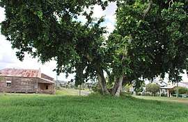 The Burnett Highway passing through Binjour, seen through a tree. The former general store can be seen to the left | |||||||||||||||
 Binjour | |||||||||||||||
| Coordinates | 25°31′S 151°27′E / 25.517°S 151.450°ECoordinates: 25°31′S 151°27′E / 25.517°S 151.450°E | ||||||||||||||
| Population | 98 (2016 census)[1] | ||||||||||||||
| • Density | 1.070/km2 (2.771/sq mi) | ||||||||||||||
| Postcode(s) | 4625 | ||||||||||||||
| Area | 91.6 km2 (35.4 sq mi) | ||||||||||||||
| Location |
| ||||||||||||||
| LGA(s) | North Burnett Region | ||||||||||||||
| State electorate(s) | Callide | ||||||||||||||
| Federal Division(s) | Flynn | ||||||||||||||
| |||||||||||||||
Binjour is a locality in the Wide Bay-Burnett region of Queensland, Australia. The locality is in the North Burnett Region local government area, and on the Burnett Highway 272 kilometres (169 mi) north of the state capital, Brisbane. At the 2016 census, Binjour had a population of 98.[1]
Geography
The Burnett Highway passes through the locality from east to west. It is within the Burnett River drainage basin.[2]
History
Binjour Plateau State School opened on 15 September 1913.[3]
Education
Binjour Plateau State School is a co-educational government primary school (P-6) at 18401 Burnett Highway. In 2016, the school had an enrolment of 16 children with 3 teachers (1 full-time equivalent) and 6 non-teaching staff (2 full-time equivalent).[4]
References
- 1 2 Australian Bureau of Statistics (27 June 2017). "Binjour". 2016 Census QuickStats. Retrieved 10 July 2017.

- ↑ "Queensland Globe". State of Queensland. Retrieved 5 August 2017.
- ↑ Queensland Family History Society (2010), Queensland schools past and present (Version 1.01 ed.), Queensland Family History Society, ISBN 978-1-921171-26-0
- ↑ "Annual Report 2016". Binjour Plateau State School. Retrieved 5 August 2017.
External links
![]()