Berutarube
| Berutarube | |
|---|---|
 | |
| Highest point | |
| Elevation | 1220-1221 metres (4,006 feet) |
| Coordinates | 44°27′32″N 146°56′10″E / 44.459°N 146.936°E |
| Geography | |
| Location | Iturup, Kuril Islands, Russia |
| Geology | |
| Mountain type | Stratovolcano |
| Last eruption | Unknown |
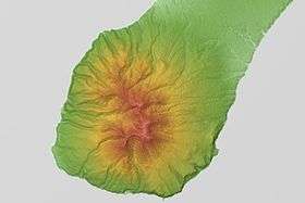
Berutarube (Russian: Берутарубе; Japanese: ベルタルベ山, Berutarube-zan) is a stratovolcano located at the southern end of Iturup Island, Kuril Islands, Russia.
See also
References
External links
- Berutarubesan (Berutarube): Global Volcanism Program - Smithsonian Institution
- Berutarubesan - Japan Meteorological Agency (in Japanese)
- "Berutarubesan: National catalogue of the active volcanoes in Japan" (PDF). - Japan Meteorological Agency
- Berutarube San - Geological Survey of Japan
| Islands | |
|---|---|
| Volcanoes |
|
| Other geographical features | |
| Cities and towns | |
| Events | |
| People | |
| |
This article is issued from
Wikipedia.
The text is licensed under Creative Commons - Attribution - Sharealike.
Additional terms may apply for the media files.