Bathurst Parish, New Brunswick
| Bathurst | |
|---|---|
| Parish | |
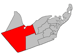 Location within Gloucester County, New Brunswick | |
| Coordinates: 47°28′N 65°52′W / 47.46°N 65.86°W | |
| Country |
|
| Province |
|
| County | Gloucester |
| Established | 1826 |
| Area[1] | |
| • Land | 1,504.80 km2 (581.01 sq mi) |
| Population (2011)[1] | |
| • Total | 4,979 |
| • Density | 3.3/km2 (9/sq mi) |
| • Pop 2006-2011 |
|
| • Dwellings | 2,223 |
| Time zone | UTC-4 (AST) |
| • Summer (DST) | UTC-3 (ADT) |
Bathurst is a Canadian parish in Gloucester County, New Brunswick.[2]
Delineation
Bathurst Parish is defined in the Territorial Division Act[3] as:
- Beginning at a point in the shoreline of the Chaleur Bay where the same is intersected by the eastern prolongation of the south limit of Lot Number One, granted to Simon Arceneau; thence in a westerly direction along said prolongation, said limit of said lot and the western prolongation of same to the most northern angle of Northumberland County; thence in a southeasterly and northeasterly direction following the Gloucester-Northumberland County line to a point in the Canadian National Railways; thence in a northerly direction along said railway to a point where the same is intersected by the western prolongation of the south limit of lots lettered A and B, granted to John Porter, said lots situated on both sides of the Highway 8;[lower-alpha 1] thence in an easterly direction along said prolongation, said limit of said lots and the eastern prolongation of same to a point in the west limit of a seven thousand, seven hundred and fifty acre tract, granted to Henry H. Swinny, situated on the head of the Big Tracadie River; thence in a southerly direction along said limit of said grant and its southern prolongation to a point in the north limit of Tier one north, Allardville East [Settlement]; thence in an easterly direction along said limit of Allardville East to a point where the same is intersected by the southern prolongation of the east limit of Lot Number twenty-nine, granted to Jacob Tague, said lot fronting on the Chaleur Bay at the mouth of Teagues Brook; thence in a northerly direction along said prolongation and said limit of said lot to a point in the shore line of Chaleur Bay; and thence following the various courses of said shoreline to the place of beginning. Including all islands in front thereof.
Communities
Parish population total does not include incorporated municipalities (in bold):
|
|
|
Demographics
Population
| Canada census – Bathurst Parish, New Brunswick community profile | |||
|---|---|---|---|
| 2011 | 2006 | ||
| Population: | 4,979 (-3.2% from 2006) | 5,144 (-6.4% from 2001) | |
| Land area: | 1,504.80 km2 (581.01 sq mi) | 1,504.23 km2 (580.79 sq mi) | |
| Population density: | 3.3/km2 (8.5/sq mi) | 3.4/km2 (8.8/sq mi) | |
| Median age: | 47.1 (M: 47.7, F: 46.7) | 43.1 (M: 43.8, F: 42.4) | |
| Total private dwellings: | 2,223 | 2,272 | |
| Median household income: | $54,540 | $52,487 | |
| References: 2011[4] 2006[5] earlier[6] | |||
| Historical Census Data - Bathurst Parish, New Brunswick[7] | ||||||||||||||||||||||||||
|---|---|---|---|---|---|---|---|---|---|---|---|---|---|---|---|---|---|---|---|---|---|---|---|---|---|---|
|
|
| ||||||||||||||||||||||||
Language
| Canada Census Mother Tongue - Bathurst Parish, New Brunswick[7] | ||||||||||||||||||
|---|---|---|---|---|---|---|---|---|---|---|---|---|---|---|---|---|---|---|
| Census | Total | French |
English |
French & English |
Other | |||||||||||||
| Year | Responses | Count | Trend | Pop % | Count | Trend | Pop % | Count | Trend | Pop % | Count | Trend | Pop % | |||||
2011 |
4,965 |
2,435 | 49.04% | 2,395 | 48.24% | 105 | 2.11% | 30 | 0.60% | |||||||||
2006 |
5,130 |
2,325 | 45.32% | 2,660 | 51.85% | 75 | 1.46% | 70 | 1.36% | |||||||||
2001 |
5,485 |
2,710 | 49.41% | 2,630 | 47.95% | 115 | 2.10% | 30 | 0.55% | |||||||||
1996 |
5,775 |
3,035 | n/a | 52.55% | 2,600 | n/a | 45.02% | 130 | n/a | 2.25% | 10 | n/a | 0.17% | |||||
See also
Footnotes
References
- 1 2 2011 Statistics Canada Census Profile: Bathurst Parish, New Brunswick
- ↑ New Brunswick Provincial Archives - Bathurst Parish
- ↑ "Territorial Division Act (R.S.N.B. 1973, c. T-3)". Government of New Brunswick website. Retrieved 17 August 2016.
- ↑ "2011 Community Profiles". Canada 2011 Census. Statistics Canada. July 5, 2013. Retrieved 2014-04-06.
- ↑ "2006 Community Profiles". Canada 2006 Census. Statistics Canada. March 30, 2011. Retrieved 2014-04-06.
- ↑ "2001 Community Profiles". Canada 2001 Census. Statistics Canada. February 17, 2012.
- 1 2 Statistics Canada: 1996, 2001, 2006, 2011 census
Places adjacent to Bathurst Parish, New Brunswick | ||||||||||
|---|---|---|---|---|---|---|---|---|---|---|
| ||||||||||
| Subdivisions | |
|---|---|
| Cities | |
| Counties | |
| |
Coordinates: 47°46′00″N 65°51′36″W / 47.76667°N 65.86000°W
This article is issued from
Wikipedia.
The text is licensed under Creative Commons - Attribution - Sharealike.
Additional terms may apply for the media files.