Barharia
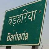
| Barharia बड़हरिया | |
|---|---|
| CD Block | |
 Barharia Location in Bihar, India | |
| Coordinates: 26°18′56″N 84°27′24″E / 26.315481°N 84.456641°ECoordinates: 26°18′56″N 84°27′24″E / 26.315481°N 84.456641°E | |
| Country |
|
| State | Bihar |
| District | Siwan |
| Subdivision | Siwan |
| Headquarters | Barhariya (town) |
| Government | |
| • Type | Bihar Government |
| Area | |
| • Total | 177.27 km2 (68.44 sq mi) |
| Elevation | 68.8 m (225.7 ft) |
| Population (2011) | |
| • Total | 321,292 |
| • Density | 1,800/km2 (4,700/sq mi) |
| Languages | |
| • Official | Bhojpuri, Hindi, Urdu, English |
| Time zone | UTC+5:30 (IST) |
| PIN | 841232 |
| Telephone code | 06154 |
| Sex ratio | 912 per 1000 ♂/♀ |
Barharia (Hindi: बङहरिया) is a Community development block and a town in the northern part of the Siwan District in the Indian state of Bihar.[1] It is one out of 13 blocks located in Siwan Subdivision. Barharia is surrounded by Manjha Block to the North, Siwan Block to the South, Goriakothi Block to the East, and Thawe Block towards North. Mirganj, Siwan, Barauli, and Gopalganj are nearby cities.
The total population of Barharia is 321,292 as of 2011 census[1] and the total area of block is 177.27 square kilometres (68.44 sq mi). Barharia town is the headquarter of this block.
It was in the national news in 2001 when part of the block was flooded by the Daha River.[2]
Demographics of Barharia
According to the 2011 Census of India the total population of Barharia block is 321,292. Out of which 164,179 are males and 157,113 are females. 68.93% people are literate. 67.14% people are Hindu and 32.57% people are Muslim in the block.[3]
Bhojpuri is the local main language whereas Hindi is the official language in Barharia block.
Climate
- Subtropical, dry climate with distinct winter, summer and rainy season.
- Highest Temperature = 43.0C (May–June)
- Lowest Temperature = 6.0 C (December–January)
- Average Rainfall = 800 mm
- Monsoon = July–September
- Humidity = 10–15%(summer), 60%(rainy)
- Visit Season = Mar–October
Education
Barharia has a well-established education infrastructure. There are a number of modern schools and colleges (both government and private) run in Barharia. Some organizations are also working in this sector to improve the educational scenario.
Colleges
- Dhayan Chand inter college (D C Inter College)
- Baba Sahab Bhimrao Ambedkar Digree College
- Gandhi Memorial High School
Schools
- G M High School (Gandhi Memorial High School)[4]
- T.H.Millat Girls' High School Barasra Barharia (Tahir Hussain Millat Girls' High School). Director:- Md Nezamuddin
- The sun shine public school.
- DA Public School.
- Iqra Public School.
- Sarswati Shisu Mandir.
- M K Ideal Public School.
- St. Xavier's School.
- Prabhat public school (Puraina)
- Al Saifi Educational and welfare Society.
- The sun shine kids school.
- Bal Vikas Vidyalaya (bahadurpur Bazar).
Transportation
Barharia is well connected with neighboring towns and cities.
Roads
SH-47 (Siwan Sarfara Road) and SH-73 (Gopalganj Maharajganj Road) State Highway passes through the Town
Intra-city transport
Buses, Railways,Jeeps, Tempo, Autos and Riksha are available for traveling. Pawan trevals bus services from siwan to jamo and Barauli via Barharia
Gram panchayats
Barharia block is divided into 30 Gram Panchayats.[5]
|
|
|
See also
References
- 1 2 "Population, Caste, Religion Data - Siwan district, Bihar". www.censusindia.co.in. Retrieved 26 June 2018.
- ↑ Thakur, Rajesk K (September 8, 2001). "Flood waters inundate more villages in Siwan". Times of India. Retrieved August 8, 2015.
- ↑ "Barharia Block Population, Caste, Religion Data - Siwan district, Bihar". www.censusindia.co.in. Retrieved 30 June 2018.
- ↑ url|http://www.chhapra.co.in/school.html
- ↑ "Panchayati Raj Department, Government of Bihar". biharprd.bih.nic.in. Retrieved 2015-08-08.
External links
Headquarter: Siwan | ||
| Siwan Subdivision | 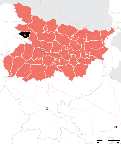 | |
| Maharajganj Subdivision | ||
| Municipalities | ||