Banning Corner, Indiana
| Banning Corner, Indiana | |
|---|---|
| Ghost town | |
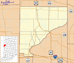 Banning Corner Location in Warren County | |
| Coordinates: 40°22′00″N 87°09′45″W / 40.36667°N 87.16250°WCoordinates: 40°22′00″N 87°09′45″W / 40.36667°N 87.16250°W | |
| Country | United States |
| State | Indiana |
| County | Warren |
| Township | Warren |
| Elevation[1] | 715 ft (218 m) |
| Time zone | UTC-5 (Eastern (EST)) |
| • Summer (DST) | UTC-4 (EDT) |
| ZIP code | 47918 |
| Area code(s) | 765 |
| GNIS feature ID | 430474 |
Banning Corner is an extinct town that was located in Warren Township in Warren County, Indiana, north of the town of Independence.
A few buildings in the community exist, and it is still cited by the USGS.[2]
Geography
Banning Corner is located at 40°22′0″N 87°09′45″W / 40.36667°N 87.16250°W. The site is situated in open farm land at the intersection of County Roads 350 North and 825 East, approximately two miles north of Independence.
References
- ↑ "US Board on Geographic Names". United States Geological Survey. October 25, 2007. Retrieved 2016-07-12.
- ↑ "Banning Corner, Indiana". Geographic Names Information System. United States Geological Survey. Retrieved July 26, 2017.
Municipalities and communities of Warren County, Indiana, United States | ||
|---|---|---|
| Towns | ||
| Townships | ||
| Unincorporated communities | ||
| Ghost towns | ||
This article is issued from
Wikipedia.
The text is licensed under Creative Commons - Attribution - Sharealike.
Additional terms may apply for the media files.