Bandon State Airport
| Bandon State Airport | |||||||||||
|---|---|---|---|---|---|---|---|---|---|---|---|
 | |||||||||||
| Summary | |||||||||||
| Airport type | Public | ||||||||||
| Operator | Oregon Department of Aviation | ||||||||||
| Location | Bandon, Oregon | ||||||||||
| Elevation AMSL | 123 ft / 37 m | ||||||||||
| Coordinates | 43°05′11.2600″N 124°24′28.31″W / 43.086461111°N 124.4078639°WCoordinates: 43°05′11.2600″N 124°24′28.31″W / 43.086461111°N 124.4078639°W | ||||||||||
| Runways | |||||||||||
| |||||||||||
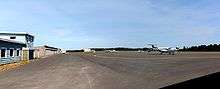
Bandon State Airport (IATA: BDY, FAA LID: S05), is a public airport located two miles (3.2 km) Southeast of the city of Bandon in Coos County, Oregon, USA.
External links
- Bandon State Airport at Oregon Department of Aviation site
- Resources for this airport:
- FAA airport information for S05
- AirNav airport information for S05
- FlightAware airport information and live flight tracker
- SkyVector aeronautical chart for S05
This article is issued from
Wikipedia.
The text is licensed under Creative Commons - Attribution - Sharealike.
Additional terms may apply for the media files.