Ballyconagan
Ballyconagan
| |
|---|---|
 Townlands of Rathlin Island | |
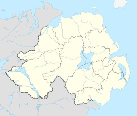 Ballyconagan Ballyconagan shown within Northern Ireland | |
| Area | 0.7145 km2 (0.2759 sq mi) [1] |
| Language |
English Gaelic |
| OS grid reference | D134518 |
| Irish grid reference | 14595 52036 D 14595 52036 |
| • Belfast | 80.12 km (49.78 mi) SSE |
| • Dublin | 217.13 km (134.92 mi) S |
| Civil parish | |
| County | |
| Country | Northern Ireland |
| Sovereign state | United Kingdom |
| Post town | Ballycastle |
| Postcode district | BT54 |
| Dialling code | 028 |
| EU Parliament | Northern Ireland |
| UK Parliament | |
| NI Assembly | |
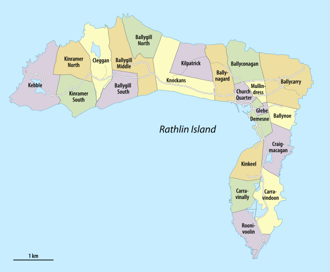
Ballyconagan is a townland in County Antrim, Northern Ireland.[1] It is located in the northeastern part of Rathlin Island and has an area of 168 acres (68 ha)
See also
References
- 1 2 "Ballyconagan Townland, Co. Antrim". townlands.ie. Retrieved 10 February 2016.
- ↑ "Ballyconagan, Rathlin Island, Ballycastle, BT54 6RT". addressesandpostcodes.co.uk. Retrieved 10 February 2016.

This article is issued from
Wikipedia.
The text is licensed under Creative Commons - Attribution - Sharealike.
Additional terms may apply for the media files.