Balabagan
| Balabagan | |
|---|---|
| Municipality | |
| Municipality of Balabagan | |
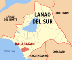 Map of Lanao del Sur with Balabagan highlighted | |
.svg.png) Balabagan Location within the Philippines | |
| Coordinates: 7°32′N 124°07′E / 7.53°N 124.12°ECoordinates: 7°32′N 124°07′E / 7.53°N 124.12°E | |
| Country |
|
| Region | Autonomous Region in Muslim Mindanao (ARMM) |
| Province | Lanao del Sur |
| District | 2nd District |
| Barangays | 27 (see Barangays) |
| Government [1] | |
| • Type | Sangguniang Bayan |
| • Mayor | Edna Ogka-Benito[2] |
| • Electorate | 14,335 voters (2016) |
| Area [3] | |
| • Total | 230.00 km2 (88.80 sq mi) |
| Population (2015 census)[4] | |
| • Total | 26,819 |
| • Density | 120/km2 (300/sq mi) |
| Time zone | UTC+8 (PST) |
| ZIP code | 9302 |
| PSGC | 153602000 |
| IDD : area code | +63 (0)63 |
| Climate type | Tropical climate |
| Income class | 4th municipal income class |
| Revenue (₱) | 85,073,610.01 (2016) |
| Native languages |
Maranao Tagalog |
| Website |
www |
Balabagan, officially the Municipality of Balabagan, is a 4th class municipality in the province of Lanao del Sur, Philippines. According to the 2015 census, it has a population of 26,819 people.[4]
Barangays
Balabagan is politically subdivided into 27 barangays.
- Banago
- Barorao
- Batuan
- Budas
- Calilangan
- Igabay
- Magulaleng Occidental
- Magulaleng Oriental
- Molimoc
- Narra
- Plasan
- Purakan
- Buisan (Bengabeng)
- Buenavista
- Lorenzo
- Lower Itil
- Macao
- Poblacion (Sultan Macaraub Masjid)
- Upper Itil
- Bagoaingud
- Ilian
- Lumbac
- Matampay
- Matanog
- Pindolonan
- Tataya
History
Balabagan became a municipality during the Presidency of Ferdinand Marcos. The area of Balabagan was owned and donated by Sultan a Dimasangkay sa Macadar.
Demographics
| Population census of Balabagan | ||
|---|---|---|
| Year | Pop. | ±% p.a. |
| 1970 | 24,494 | — |
| 1975 | 22,633 | −1.57% |
| 1980 | 12,979 | −10.52% |
| 1990 | 18,146 | +3.41% |
| 1995 | 21,557 | +3.28% |
| 2000 | 24,558 | +2.83% |
| 2007 | 33,421 | +4.34% |
| 2010 | 25,139 | −9.84% |
| 2015 | 26,819 | +1.24% |
| Source: Philippine Statistics Authority[4] [5] [6] [7] | ||
References
- ↑ "Municipality". Quezon City, Philippines: Department of the Interior and Local Government. Retrieved 31 May 2013.
- ↑ Jacinto, Al (26 February 2016). "VICE MAYOR REFUSES TO STEP DOWN - Tension grips Lanao Sur town hall". The Manila Times. Retrieved 23 March 2016.
- ↑ "Province: Lanao del Sur". PSGC Interactive. Quezon City, Philippines: Philippine Statistics Authority. Retrieved 12 November 2016.
- 1 2 3 Census of Population (2015). "ARMM – Autonomous Region in Muslim Mindanao". Total Population by Province, City, Municipality and Barangay. PSA. Retrieved 20 June 2016.
- ↑ Census of Population and Housing (2010). "ARMM – Autonomous Region in Muslim Mindanao". Total Population by Province, City, Municipality and Barangay. NSO. Retrieved 29 June 2016.
- ↑ Censuses of Population (1903–2007). "ARMM – Autonomous Region in Muslim Mindanao". Table 1. Population Enumerated in Various Censuses by Province/Highly Urbanized City: 1903 to 2007. NSO.
- ↑ "Province of Lanao del Sur". Municipality Population Data. Local Water Utilities Administration Research Division. Retrieved 17 December 2016.
External links
- Philippine Standard Geographic Code
- Philippine Census Information
- Local Governance Performance Management System
- www.gmanews.tv/video, Saksi: Triplets born in Lanao del Sur - 26 January 2008
Places adjacent to Balabagan | ||||||||||
|---|---|---|---|---|---|---|---|---|---|---|
| ||||||||||
This article is issued from
Wikipedia.
The text is licensed under Creative Commons - Attribution - Sharealike.
Additional terms may apply for the media files.