Bagot, Manitoba
| Bagot | |
|---|---|
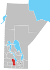
 Bagot Location of Bagot in Manitoba | |
| Coordinates: 49°58′9″N 98°37′48″W / 49.96917°N 98.63000°WCoordinates: 49°58′9″N 98°37′48″W / 49.96917°N 98.63000°W | |
| Country |
|
| Province |
|
| Region | Central Plains |
| Census Division | No. 8 |
| Government | |
| • Mayor | Travis Nearing |
| • Governing Body | Rural Municipality of North Norfolk Council |
| • MP | Candice Bergen |
| • MLA | Stu Briese |
| Time zone | UTC−6 (CST) |
| • Summer (DST) | UTC−5 (CDT) |
| Postal Code | R0H 0E0 |
| Area code(s) | 204, 431 |
| NTS Map | 062G15 |
| GNBC Code | GABLM |
| motto- Facta Non Verba | |
Bagot is an unincorporated community located in the Rural Municipality of North Norfolk in south central Manitoba, Canada. It is located approximately 24 kilometers (15 miles) west of Portage la Prairie,[1] on Provincial Road 242. It was established as a Canadian Pacific Railroad point in 1881 and named by the Marquis of Lorne, Governor General of Canada, after his aide-de-camp Captain, the Honourable W. R. Bagot, later the fourth Baron of Bagot.[2]
References
- ↑ "Geographical Names of Canada - Querying Distances". nrcan.gc.ca. 2011-10-24. Archived from the original on 2014-04-16. Retrieved 2013-08-27.
- ↑ Manitoba Place Names
Division No. 8, Manitoba (Central Manitoba) | ||||
|---|---|---|---|---|
| Towns |
|  | ||
| Villages |
| |||
| Rural municipalities |
| |||
| First Nations | ||||
| Indian reserves |
| |||
| Unincorporated communities | ||||
This article is issued from
Wikipedia.
The text is licensed under Creative Commons - Attribution - Sharealike.
Additional terms may apply for the media files.