Rathwell, Manitoba

Rathwell
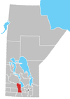
Location of Rathwell in Manitoba
Rathwell is an unincorporated urban centre in the province of Manitoba. It is part of the agricultural area of south central Manitoba and is situated in the Rural Municipality of Norfolk Treherne.
Climate
| Climate data for Rathwell | |||||||||||||
|---|---|---|---|---|---|---|---|---|---|---|---|---|---|
| Month | Jan | Feb | Mar | Apr | May | Jun | Jul | Aug | Sep | Oct | Nov | Dec | Year |
| Record high °C (°F) | 7.5 (45.5) |
10 (50) |
18.5 (65.3) |
35 (95) |
38.5 (101.3) |
37.5 (99.5) |
36.1 (97) |
40 (104) |
38.5 (101.3) |
32 (90) |
23.9 (75) |
14.4 (57.9) |
40 (104) |
| Average high °C (°F) | −12 (10) |
−7.5 (18.5) |
−0.7 (30.7) |
10.3 (50.5) |
19.3 (66.7) |
23.4 (74.1) |
25.6 (78.1) |
25.3 (77.5) |
18.9 (66) |
11.2 (52.2) |
−0.7 (30.7) |
−9 (16) |
8.7 (47.7) |
| Daily mean °C (°F) | −16.9 (1.6) |
−12.5 (9.5) |
−5.6 (21.9) |
4.2 (39.6) |
12.2 (54) |
17 (63) |
19.2 (66.6) |
18.3 (64.9) |
12.6 (54.7) |
5.6 (42.1) |
−5 (23) |
−13.5 (7.7) |
3 (37) |
| Average low °C (°F) | −21.8 (−7.2) |
−17.5 (0.5) |
−10.5 (13.1) |
−1.9 (28.6) |
5.1 (41.2) |
10.5 (50.9) |
12.7 (54.9) |
11.3 (52.3) |
6.2 (43.2) |
0 (32) |
−9.2 (15.4) |
−18 (0) |
−2.8 (27) |
| Record low °C (°F) | −38.3 (−36.9) |
−42 (−44) |
−45.6 (−50.1) |
−27.8 (−18) |
−12.5 (9.5) |
−1.5 (29.3) |
1.5 (34.7) |
−2.5 (27.5) |
−6.7 (19.9) |
−19.5 (−3.1) |
−35.5 (−31.9) |
−38.5 (−37.3) |
−42 (−44) |
| Average precipitation mm (inches) | 23.2 (0.913) |
20.2 (0.795) |
25.3 (0.996) |
32.9 (1.295) |
59.6 (2.346) |
78.7 (3.098) |
78.2 (3.079) |
60.5 (2.382) |
51.8 (2.039) |
39.3 (1.547) |
28 (1.1) |
26.8 (1.055) |
524.3 (20.642) |
| Source: Environment Canada[1] | |||||||||||||
References
- ↑ "Canadian Climate Normals 1971–2000". Environment Canada. Retrieved 24 August 2012.
External links
Division No. 8, Manitoba (Central Manitoba) | ||||
|---|---|---|---|---|
| Towns |
|  | ||
| Villages |
| |||
| Rural municipalities |
| |||
| First Nations | ||||
| Indian reserves |
| |||
| Unincorporated communities | ||||
Coordinates: 49°38′49″N 98°32′47″W / 49.64694°N 98.54639°W
This article is issued from
Wikipedia.
The text is licensed under Creative Commons - Attribution - Sharealike.
Additional terms may apply for the media files.