Băicoi
| Băicoi | ||
|---|---|---|
| Town | ||
| ||
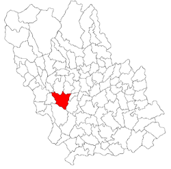 Location of Băicoi | ||
| Coordinates: 45°2′43″N 25°51′57″E / 45.04528°N 25.86583°ECoordinates: 45°2′43″N 25°51′57″E / 45.04528°N 25.86583°E | ||
| Country |
| |
| County | Prahova County | |
| Status | Town | |
| Government | ||
| • Mayor | Ciprian Stătescu (PNL) | |
| Area | ||
| • Total | 65.36 km2 (25.24 sq mi) | |
| Population (2011) | ||
| • Total | 17,981 | |
| Time zone | UTC+2 (EET) | |
| • Summer (DST) | UTC+3 (EEST) | |
| Climate | Dfb | |
| Website | http://primariabaicoi.ro/ | |

Băicoi (Romanian pronunciation: [bəjˈkoj]) is a town in Prahova county, Romania, near the 45th parallel. It lies near Florești, a train stop between Ploiești and Câmpina. Five localities are administered by the town: Dâmbu, Liliești, Schela, Tufeni and Țintea. Over time, these have become neighborhoods of the town.[1] Bӑicoi is situated in the historical region of Muntenia.
History
| Historical population | ||
|---|---|---|
| Year | Pop. | ±% |
| 1956 | 8,287 | — |
| 1966 | 9,120 | +10.1% |
| 1977 | 17,440 | +91.2% |
| 1992 | 20,681 | +18.6% |
| 2002 | 20,020 | −3.2% |
| 2011 | 17,981 | −10.2% |
| Source: Census data | ||
Its name is derived from "Baicu", a Romanian name of possibly Cuman origin.
Notes
- ↑ (in Romanian) "Population" at the Băicoi Town Hall site; accessed March 15, 2013
External links
| Wikimedia Commons has media related to Băicoi. |

This article is issued from
Wikipedia.
The text is licensed under Creative Commons - Attribution - Sharealike.
Additional terms may apply for the media files.