Atchampet mandal, Guntur district
| Atchampet mandal | |
|---|---|
| Mandal | |
| Atchampet H/O Chamarru | |
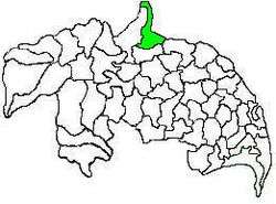 Mandal map of Guntur district showing Atchampet mandal (in green) | |
| Country | India |
| State | Andhra Pradesh |
| District | Guntur |
| Headquarters | Atchampet |
| Government | |
| • Body | Mandal Parishad |
| • Tehsildar | G.Sujatha |
| Area[1] | |
| • Total | 191.17 km2 (73.81 sq mi) |
| Population (2011) | |
| • Total | 58,447 |
| • Density | 310/km2 (790/sq mi) |
| Languages | |
| • Official | Telugu |
| Time zone | UTC+5:30 (IST) |
Atchampet mandal (officially Atchampet H/O Chamarru) is one of the 57 mandals in Guntur district of the Indian state of Andhra Pradesh. The mandal is under the administration of Guntur revenue division and the headquarters are located at Atchampet.[1] The mandal is located on the banks of Krishna River, at a distance 68 km from the district headquarters. It is bounded by Amaravathi, Krosuru, Pedakurapadu, Bellamkonda and Sattenapalli mandals.[2]
Demographics
As of 2011 census, the mandal had a population of 58,447. The total population constitute, 29,749 males and 28,698 females —a sex ratio of 965 females per 1000 males. 6,676 children are in the age group of 0–6 years.[1]
Government and politics
The mandal is under the control of a tahsildar and the present tahsildar is G.Sujatha.[3] Atchampet mandal is one of the 5 mandals under Pedakurapadu (Assembly constituency), which in turn represents Narasaraopet (Lok Sabha constituency) of Andhra Pradesh.[4]
Jurisdiction
As of 2011 census, the mandal has 18 villages.[1]
The settlements in the mandal are listed below:
- Ambadipudi
- Challagariga
- Chamarru
- Chigurupadu
- Chintapalle
- Ginjupalle
- Kastala Agraharam
- Kogantivaripalem
- Konduru
- Konuru
- Madipadu Agraharam
- Madipadu Seri
- Mittapalem
- Orvakallu
- Pedapalem
- Taduvoy
- Tallacheruvu
- Velpuru
See also
References
- 1 2 3 4 "District Census Handbook - Guntur" (PDF). Census of India. p. 14,240. Retrieved 4 January 2016.
- ↑ "Guntur District Mandals" (PDF). Census of India. pp. 59, 107. Retrieved 4 January 2016.
- ↑ "List of Tahsildars working in Guntur District as on 19.06.2014" (PDF). Guntur District Official Website. National Informatics Centre. p. 1. Retrieved 8 September 2014.
- ↑ "Delimitation of Parliamentary and Assembly Constituencies Order, 2008" (pdf). Election Commission of India. p. 22. Retrieved 11 October 2014.
External links
Places adjacent to Atchampet mandal, Guntur district | ||||||||||
|---|---|---|---|---|---|---|---|---|---|---|
| ||||||||||