Askeran Province
| Askeran Ասկերան | |
|---|---|
| Province | |
 | |
| Capital | Askeran |
| Government | |
| • Governor | Sergey Grigoryan |
| Area | |
| • Total | 1,222 km2 (472 sq mi) |
| Area rank | Ranked 5th |
| Population (2013) | |
| • Total | 18,251 |
| • Rank | Ranked 4th |
| • Density | 15/km2 (39/sq mi) |
| Website | Askeran Province |
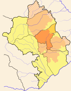
Askeran Province (Armenian: Ասկերան)is a province of the de facto Republic of Artsakh. The Republic has limited international recognition. It is de jure part of the Republic of Azerbaijan and is almost coterminous with Khojaly District. It is in the center of Artsakh, surrounding the capital, Stepanakert. It is notable for the ruins of Tigranakert.
Settlemnents
There are 42 communities in the province of which 1 is considered urban and 41 are considered rural.
Geography
Askeran adjoins Martakert Region on the north, Agdam District of Azerbaijan on the east. Hadrut Region and Shushi Region in the south, Martuni Region in the south east and Kashatagh Region on the west. Stepanakert, the capital of the Republic of Artsakh, is located south-west of the province.
.jpg)
History
During the Middle Ages the left side of the Askeran Province was part of Principality of Khachen and the right side Varanda the center of which was Avetaranots, located in the south of the region.
Following the formation of the Nagorno-Karabakh Autonomous Oblast a raion was formed which was centered on Stepanakert. In 1978, Askeran became the center of the raion, and the raion was renamed to Askeran. A total of 52 settlements were registered in 1979.
As the Karabakh conflict started, the Azerbaijani government began to implement a plan to create a new district center. From 1988 to 1990 the population of Khojaly village was increased from 2135 to 6000 residents. These mainly consisted of immigrants from Central Asia (more than 2000 Meskhetian Turks) and Armenia (about 2000). In April 1990, Khojaly received a city status, becoming a regional center.
From the Azeri perspective, the newly created Khojaly District includes what is de facto Askeran Province as well as a part of the former district of Martuni.[1] This former part of Martuni District is nominally part of Agdam District.
References
Capital: Askeran | ||
| Urban comunities | | |
| Rural comunities |
| |
| Capital city | ||
|---|---|---|
| Provinces | ||
| Provincial capitals | ||
| Other urban communities | ||
1 Claimed by the Republic of Artsakh but partly under Azerbaijani control. | ||
| Background | |
|---|---|
| Nagorno-Karabakh War |
|
| Post-war clashes | |
| Main locations | |
| Political leaders | |
| Military leaders |
|
| Peace process | |
| International documents | |