Çığlı, Çukurca
| Çığlı Ashita | |
|---|---|
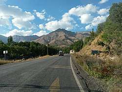 Entrance to the village | |
 Çığlı | |
| Coordinates: 37°19′55″N 43°22′46″E / 37.33194°N 43.37944°ECoordinates: 37°19′55″N 43°22′46″E / 37.33194°N 43.37944°E | |
| Country |
|
| Province | Hakkâri |
| Government | |
| • Mayor | Servet Tunç (BDP) |
| • Kaymakam | Levent Öztin |
| Elevation | 1,500 m (4,900 ft) |
| Post code | 30700 |
| Area code(s) | 0438 |
| Website | www.cukurca.bel.tr |
Çığlı is a village in Çukurca, Hakkari province in Turkey.[1]
History
Historically, the name of the village was Ashita (meaning avalanche in Assyrian) and it was originally inhabited by Assyrians (or Syriac Christians). The name "Çığlı" is given by the official authorities and is not used by the locals.[2]
It is the principal village of the region known as Tyari Valley in history. The Tyari tribe, which consists of Nestorian Christians, has passed history records since the 14th century. In 1846, the massacre committed by the Ottoman Turks against the Tyari Assyrians became an international problem and resulted in the destruction of the Hakkari principality. Many Christian Nestorians were displaced in 1915 during the Assyrian genocide.[3]
The second president, Ismet Inonu, comes from the descendants of a family who emigrated to Bitlis from Tyari Valley in the 1840s.
Culture
Many traditional foods of the village are from the Hakkari region, and there are also different kinds of dishes. In the village there are customs rules which are based on the old ones. All the men and women in the country are looking for local outfits and they are called 'şelu şekık and kırasu sermıl'. There are old churches and old houses and things in the village. The village is not poor in terms of historical monuments. There are old houses, a monastery and various Assyrian sculptures.[4]
Geography
The village is heavily mountainous with hot dry summers and cold, wet winters, having a continental climate. It is 73 km away from Hakkari province and 35 km away from Çukurca district. It is located on the Iraq border, on Sirnak - Hakkari Highway. Çığlı Water passes through it.
Population
| Population data by year | |
|---|---|
| 2007 | 2,350 |
| 2000 | 1,912 |
| 1997 | 1,907 |
Economy
Some livestock farming is done in the village. Agriculture is constricted due to the limited arable land to be tried. Since the village's economy is mostly on the Iraqi border, it is largely based on smuggling.
See also
- Assyrian homeland
- Jilu, an Assyrian tribe
- Tiyari
- Barwari
- Tkhuma Tribe
- Ortaköy, Uludere, formerly known as Assyrian tribe of Arosh
- Andaç, Uludere, former tribes of Geramon and Halmon
References
- ↑ https://www.yerelnet.org.tr/koyler/koy.php?koyid=311718
- ↑ Layard, Austen Henry, Discoveries in the ruins of Nineveh and Babylon: with travels in Armenia, Kurdistan and the desert: being the result of a second expedition undertaken for the Trustees of the British Museum, London: G.P. Putnam and Co., 1853, p. 434
- ↑ Wilmshurst, David, The ecclesiastical organisation of the Church of the East, 1318-1913, Leuven: Peeters Publishers, 2000, p. 300
- ↑ Beth-Zay‘ā, Esha‘yā Shamāshā Dāwīd, Tash‘īthā d-Beth-Nahreyn, Tehran: Assyrian Youth Cultural Society Press, 1963, p. 895