Asaba, Delta
| Asaba Àhàbà Ahaba | |
|---|---|
| City | |
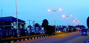 Summit road, Asaba | |
| Nickname(s): Ani Mmili | |
 Asaba Location in Nigeria
f | |
| Coordinates: 6°11′52.23″N 6°43′42.48″E / 6.1978417°N 6.7284667°ECoordinates: 6°11′52.23″N 6°43′42.48″E / 6.1978417°N 6.7284667°E | |
| Country |
|
| State | Delta State |
| LGA(s) | Aniocha North, Aniocha South, Oshimili North, Oshimili South. Aniocha-Oshimili constituency |
| Area | |
| • Total | 268 km2 (103 sq mi) |
| Population (2006 census)[1] | |
| • Total | 149,603 |
| • Estimate (2011) | 176,060[2] |
| • Density | 560/km2 (1,400/sq mi) |
| Climate | Aw |
| Website |
asaba |
Asaba (Igbo: Àhàbà)[3] is a city strategically located on a hill at the western edge of the Niger River, overlooking its sister city, Onitsha, across the Niger Bridge.[4][5][6][7] It is the capital of Delta State Nigeria. A fast developing urban area, Asaba had a population of 149,603 as at the 2006 census,[8] and a metropolitan population of over half a million people.[9][4]
Etymology
Ahaba in Enuani dialect of the great Igbo language is derived from the exclamation Ahabagom, meaning "I have chosen well", a quote from the founding father (Nnebisi) of Asaba.[10][4][5]
History
The city of Asaba was once the colonial capital of the Southern Nigeria Protectorate.[7] It was founded in 1884.[11] Between 1886 and 1900, it hosted the Royal Niger Company, which the British authorities set up to stimulate trade and the exportation of goods to England.[7] That company has grown today into UAC Nigeria PLC. Scottish explorer William B. Balkie, when signing a trade treaty with Igbo chief Ezebogo in Asaba on August 30, 1885, remarked "After our salutations, I spoke of friendship, of trade, and of education, and particularly enlarged upon the evils of war, and the benefits of peace, all of which was well received".[12]:318
Owing to Asaba's influential history and geography, and current strategic political and economic influence in Nigeria, Asaba is generally known as the regional capital of the Anioma area.[13] The clamour for creation of Anioma state has been going on for decades.[13]
Geography
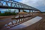
Asaba is situated on a terrace of the lower Niger River, overlooking the point where the Anambra River flows into it. Beyond the river banks, on the high plains which are far more extensive than the river basins, secondary forest vegetation flourishes.[5] The historic Niger River is a trans-African link beginning from West Africa and down into the Atlantic Ocean.[4] Asaba forms a connector between western, eastern and northern Nigeria through the Niger River from the north and via the Asaba Niger Bridge, an east-west link and a Nigerian landmark.[4]
Asaba lies approximately 60 degrees north of the equator and about the same distance east of the meridian; about 160 kilometres (100 mi) north of where the River Niger flows into the Atlantic Ocean.[5] The greater Asaba occupies an area of about 300 square kilometers. It maintains an average tropical temperature of 32 °C during the dry season and an average fertile rainfall of 2,700 millimetres (106 in) during the rainy season.
Demographics
Asaba is traditionally led by the highly revered Asagba of Asaba, to whom the head (“Diokpa”) of each of the five Ebos reports directly into on matters affecting Asaba.[5][4] Greater Asaba includes some of the other neighbouring indigenous Igbo communities—Ogwashi Ukwu, Igbuzo, Okpanam, Ugbolu and Oko —on the western section of the Niger River.
Since becoming the administrative capital of Delta State, Asaba has grown in population to over half a million very hospitable people. Today, it maintains a cosmopolitan population of predominantly non-indigenous people.[4] Some of the other groups in the city include Urhobo, Isoko, Ijaw, Ukwuani, Hausa, Itsekiri and Yoruba people.
Economy
Asaba is an administrative area established during the time of the Royal Niger Company (now UACN) and is currently enjoying the status of being the administrative capital of Delta state but due to the fact that Aniocha-Oshimili people maintains the identity of being Igbo, a lot of Igbo from the east of the Niger river invest in Delta state and precisely at Asaba thus improving the economic fortunes of Asaba area and Delta state in general. The government also contributes to the economic development of Asaba especially considering the established Asaba textile factory constructed by Samuel Ogbemudia administration[14] and the power substation at Asaba. The city of Asaba also hosts Sure life pharmaceutical company that manufactures medicines, there is also a steel mill in the city and aluminium companies manufacturing aluminum products. The Nigerian Federal Government is also trying to capitalize on the Ubu river in the Ogwashi ukwu area of the African city through the construction of a multipurpose dam that could be useful in generating electricity and the lake that will form behind the dam could benefit the Nigerian Navy Maritime University which is also within the city and there are possibilities that the Muhammadu Buhari led administration would complete the dam project between 2018 and 2019[15] .
Transport
Air
The city of Asaba and neighbouring cities are accessible by air through the Asaba international airport.
Road
Asaba Benin express road is an important road which connects parts of eastern Nigeria with western Nigeria. There is also a road that connects Asaba areas with Ughelli while the Asaba-Ebu road connects the city of Asaba with northern Nigeria.
Water
Asaba is served by the water transportation available through the Niger River which surrounds most parts of the African city.
Notable people
- Chief Dennis Osadebay[16]
- Joseph Chike Edozien[16]
- Maryam Babangida[16]
- Emmanuel C. Elikwu[16]
See also
References
- ↑ "FEDERAL REPUBLIC OF NIGERIA : 2006 Population Census" (PDF). Web.archive.org. Archived from the original (PDF) on 5 March 2012. Retrieved 25 July 2016.
- ↑ "Delta (state, Nigeria)". population.de. Retrieved 25 July 2016.
- ↑ Isichei, Elizabeth Allo (1997). A History of African Societies to 1870. Cambridge University Press. p. 249. ISBN 0-521-45599-5. Retrieved December 13, 2008.
- 1 2 3 4 5 6 7 "About Asaba". asaba.com/about/. Retrieved April 21, 2016.
- 1 2 3 4 5 "Asaba Progressive Union". www.asabaatl.org/about.html. Archived from the original on May 7, 2016. Retrieved April 22, 2016.
- ↑ Okenwa Nwosu (Igbo Focus) (January 2, 2014). "The Politics of Second Niger Bridge". www.igbofocus.co.uk. Retrieved April 21, 2016.
- 1 2 3 "Asaba". www.britannica.com. Retrieved April 24, 2016.
- ↑ "FEDERAL REPUBLIC OF NIGERIA : 2006 Population Census" (PDF). Wayback Machine. Archived from the original (PDF) on March 5, 2012. Retrieved July 25, 2016.
- ↑ "A History and Tradition". Asaba Online. Asaba Progressive Front. Archived from the original on 2007-09-15. Retrieved June 19, 2007.
- ↑ "Great Goddess And Shrine Of Asaba People". Leadership. 23 September 2016. Archived from the original on 24 September 2016. Retrieved 4 February 2017.
- ↑ Letters from Nigeria,D.W. Carnegie,BiblioBazaar, LLC, ISBN 978-1-103-27100-9
- ↑ BAIKIE, WILLIAM BALEOUR (1856). "Narrative of an Exploring Voyage up the rivers of Kwora and Binue commonly known as Niger and TSADDA in 1885 with a map and appendices". ia600303.us.archive.org. John Mueray, Albemarle Street (Published with a santion of Her Majesty's Government). Retrieved April 24, 2016.
- 1 2 "Anioma: Nigeria 37th State in the Making". umuanioma.com. Retrieved April 22, 2016.
- ↑ "Samuel Osaigbovo Ogbemudia (1932=2017)". Guardian (Nigeria). 24 March 2017. Retrieved February 18, 2018.
- ↑ "FG to complete 21 other dams, irrigation projects by 2019". TheNation (Nigeria). 11 November 2017. Retrieved March 21, 2018.
- 1 2 3 4 "Asaba. A long history and Tradition". Asaba Online. 23 August 2009. Retrieved October 11, 2016.
External links
- Asaba.com
- Asaba Association Non-profit Group
- Asaba Development Association in the United Kingdom
- Asaba Portal
- Asaba History and Culture Collaboration Research Platform
Igbo topics | |||||
|---|---|---|---|---|---|
| History (chronological order) | |||||
| Subgroups | |||||
| Politics | |||||
| Geography (Igboland) |
| ||||
| Demographics | |||||
| Culture | |||||
| Language |
| ||||
| Wikipedia | |||||
| |||||