Asaba, Shizuoka
| Asaba 浅羽町 | |||
|---|---|---|---|
| Former municipality | |||
| |||
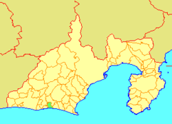 Location of Asaba in Shizuoka Prefecture | |||
 Asaba Location in Japan | |||
| Coordinates: 34°42′49″N 137°55′27″E / 34.7136°N 137.9241°ECoordinates: 34°42′49″N 137°55′27″E / 34.7136°N 137.9241°E | |||
| Country | Japan | ||
| Region | Chūbu (Tōkai) | ||
| Prefecture | Shizuoka Prefecture | ||
| District | Iwata | ||
| Merged |
April 1, 2005 (now part of Fukuroi) | ||
| Area | |||
| • Total | 28.46 km2 (10.99 sq mi) | ||
| Population (March 1, 2005) | |||
| • Total | 19,306 | ||
| • Density | 678/km2 (1,760/sq mi) | ||
| Symbols | |||
| • Tree | Japanese black pine | ||
| • Flower | Azalea | ||
| • Bird | Barn swallow | ||
| Time zone | UTC+9 (JST) | ||


Asaba (浅羽町 Asaba-chō) was a town located in Iwata District, Shizuoka Prefecture, Japan.
As of 2005, the town had an estimated population of 19,306 and a density of 678 persons per km2. The total area was 28.46 km2.
Asaba Town was created from Asaba Village in 1956.
On April 1, 2005, Asaba was merged into the expanded city of Fukuroi and thus no longer exists as an independent municipality.
This article is issued from
Wikipedia.
The text is licensed under Creative Commons - Attribution - Sharealike.
Additional terms may apply for the media files.