Arnside and Silverdale
| Arnside and Silverdale | |
| Area of Outstanding Natural Beauty | |
 | |
| Country | England |
|---|---|
| County | Cumbria, Lancashire |
| Location | Northern England |
| Highest point | Warton Crag |
| - elevation | 163 m (535 ft) |
| Area | 75 km2 (29 sq mi) |
| Plants | ash, hazel, oak |
| Animals | bittern |
| Founded | 1972 |
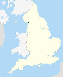 Location of the Arnside and Silverdale AONB in the UK | |
Arnside and Silverdale is an Area of Outstanding Natural Beauty in England, on the border between Lancashire and Cumbria, adjoining Morecambe Bay. One of the smallest AONBs, it covers 29 square miles (75 km2) between the Kent Estuary, the River Keer and the A6 road. It was designated in 1972.
The area is characterised by low hills of Carboniferous Limestone, including Arnside Knott (522 feet) and Warton Crag (535 feet), interspersed with grassland. Much of the area is covered by deciduous woodland, in which ash, oak, and hazel predominate. The coastal area contains large extents of salt marsh, although these are under threat from the shifting channel of the Kent Estuary.
The Leighton Moss nature reserve, owned by the RSPB, is the largest area of reedbeds in North West England, and is an Important Bird Area.[1] The bittern, one of the resident species, has been adopted as the logo of the AONB. In addition, there are fifteen SSSIs in the area; one of these, Gait Barrows National Nature Reserve, is home to some rare species of butterfly including the high brown fritillary.
Arnside and Silverdale are the main villages in the area. Other settlements include Warton, Yealand Redmayne, Beetham and Storth.
References
- ↑ BirdLife International (2015) Important Bird Areas factsheet: Leighton Moss. Downloaded from "Archived copy". Archived from the original on 2007-07-10. Retrieved 2014-03-07. on 08/01/2015
Coordinates: 54°10′35″N 2°47′29″W / 54.17639°N 2.79139°W
| East of England | 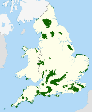 | |
|---|---|---|
| East Midlands | ||
| North East | ||
| North West | ||
| South East | ||
| South West | ||
| West Midlands | ||
| Yorkshire and Humber | ||
1 Now part of South Downs National Park • 2 Now part of New Forest National Park • 3 Partly in Wales | ||