River Kent
River Kent | |
 | |
| Country | England |
|---|---|
| Tributaries | |
| - left | Mint, Sprint, Bela |
| - right | Gowan, Gilpin, Winster |
| Source | Hall Cove above Kentmere reservoir |
| Mouth | Morecambe Bay |
| Length | 32 km (20 mi) |
| Discharge | for Sedgwick |
| - average | 8.94 m3/s (316 cu ft/s) |
| - max | 441.0 m3/s (15,574 cu ft/s) 8 January 2005 |
| - min | 0.47 m3/s (17 cu ft/s) 24 August 1984 |
| Discharge elsewhere (average) | |
| - Burneside | 3.74 m3/s (132 cu ft/s) |
| River Kent | |
|---|---|
|
IUCN category IV (habitat/species management area) | |
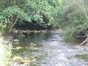 River Kent near its source in Kentmere | |
| Area | 109.12 ha |
The River Kent is a short river in the county of Cumbria in England. The river originates in hills surrounding Kentmere, and flows for around 20 miles (32 km) into the north of Morecambe Bay. The Lake District National Park includes the upper reaches of the river within its boundaries.
The river passes through Kentmere, Staveley, Burneside, Kendal and Sedgwick. Near Sedgwick, the river passes through a rock gorge which produces a number of low waterfalls. This section is popular with kayakers as it offers high quality whitewater for several days after rain.
The village of Arnside lies alongside the Kent estuary. On high spring tides, a tidal bore known as the Arnside Bore forms in the estuary opposite Arnside. The wave is often about 0.5m high.
Tributaries
The rivers Mint, Sprint and Gowan join the Kent to the north of Kendal, with the river also joined by the River Gilpin and River Winster as it nears its estuary.
- Lingmell Gill (into Kentmere Reservoir)[1]
- Skeel Gill and Bryant's Gill
- Ullstone Gill
- Nunnery Beck
- Kill Gill
- Hall Gill
- Park Beck
- Hall Beck
- River Gowan
- River Sprint
- River Mint
- River Gilpin
- River Bela
- River Winster
Energy
Near the source of the river is Kentmere Reservoir, which was constructed in the mid-19th century to control the flow of the river for the benefit of water mills. The river was used to power numerous mills in the past,[1] including two at Staveley, Kentmere water mill, and also the James Cropper paper factory at Burneside. One of the weirs at Staveley produces electricity for Staveley Mill Yard via a micro hydro scheme. There is also scope for micro hydro upstream at Kentmere.[2][3]
Wildlife
The river is a designated Special Area of Conservation, primarily as an important habitat for the endangered White-clawed Crayfish (Austropotamobius pallipes).[4]
Fish species include salmon and trout. In the twentieth century fish ladders were constructed alongside the dams of mill-ponds to allow migratory fish to swim up to Kentmere. In 2013 DEFRA funding was announced for eel passes at Stramongate weir in Kendal and Basinghyll fish counter.

References
- 1 2 "River Kent Info". Retrieved 22 April 2011.
- ↑ Stewart, Natalie (25 December 2009). "Community hydro power scheme planned for Lake District village". Westmorland Gazette. Retrieved 6 November 2013.
- ↑ Tunningley, Alan (22 July 2010). ""Power to the people"". Westmorland Gazette.
- ↑ River Kent: site details, Joint Nature Conservation Committee
- ↑ Newsletter (Spring 2013). South Cumbria Rivers Trust